|
New MARPLOT and ALOHA Released
New versions of the MARPLOT mapping program and ALOHA chemical hazard model are now available. The updated programs are part of the CAMEO software suite, created for hazmat responders and planners by OR&R in collaboration with EPA. The programs are available at no cost.
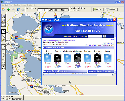
Working in MARPLOT's easy-to-use GIS interface, users can switch between three basemaps: standard map files, high-resolution aerial photos, and topographical maps. They can get population estimates inside selected areas and can customize maps using drawing tools and an extensive symbol set. Right-clicking on a location of interest displays its elevation and an instant weather forecast. ALOHA threat zones, representing the area that could be at risk from a chemical release, fire, or explosion, can easily be displayed on the map. The latest U.S. Census county maps, and state and national map layers automatically download as needed. MARPLOT 4.0 is compatible with Windows XP and Vista (and can be run on Intel-based Macintoshes using Boot Camp or virtualization software). MARPLOT 4.0 can be downloaded from the CAMEO Web site.
ALOHA now includes an updated chemical library. ALOHA 5.4.1.1 is compatible with Microsoft Windows and Macintosh OS X. ALOHA can be downloaded from the CAMEO Web site.
 |
|
ALOHA threat zone displayed on an aerial photo in MARPLOT
|
 |
|
Instant weather forecast produced by MARPLOT
|
|