|
|
projects > baseline hydrologic data collection along the i-75/state road 29 corridor in the big cypress national preserve
Baseline Hydrologic Data Collection along the I-75/State Road 29 Corridor in the Big Cypress National Preserve
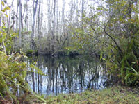
The objectives of this study for the 2006 water year are to develop a program of surface water flow monitoring across I-75 and SR 29 in the I-75 corridor from Snake Road west to SR 29 and SR 29 from I-75 south to USGS site 02291000 Barron River Near Everglades, Florida. Quarterly discharge measurements will be accomplished along both reaches to begin to assess hydrologic flow patterns and evaluate the feasibility of creating a stage-discharge/index-velocity relationship for this area. Work PlansProject SummariesData
Metadata |
U.S. Department of the Interior, U.S. Geological Survey
This page is: http://sofia.usgs.gov/projects/index.php?project_url=75_29_flows
Comments and suggestions? Contact: Heather Henkel - Webmaster
Script last updated: 04 February 2009 @ 10:18 AM by BJM. Record creator: BJM. Record last updated by: KP.