Flood Risk
 Much of the watershed was severely burned in the Gap fire of July, 2008.
Because of this, downstream areas are at high risk for flash flooding or debris flows. This webcam will allow area
residents to evaluate real-time conditions in the channel during storms.
Much of the watershed was severely burned in the Gap fire of July, 2008.
Because of this, downstream areas are at high risk for flash flooding or debris flows. This webcam will allow area
residents to evaluate real-time conditions in the channel during storms.
|
NWS Radar
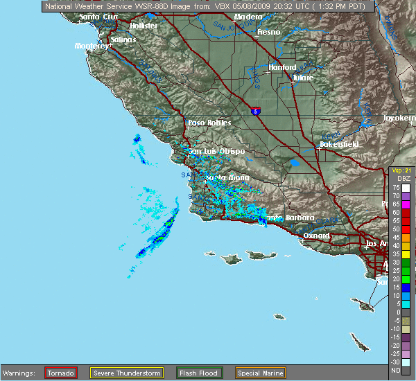
Enlarge
|
Solar-powered Webcam
 Because of th eremotness of this location, this is a self-sustaining webcam, powered by a solar-and-battery system iand utilizing 3G wireless internet access.
|


)