|
| |
Thomas Jefferson and the Virginia Capes Wrecks
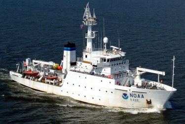 |
In 1983, while sailing off the coast of North Carolina and Virginia, fishermen hauled up the oldest English cannon ever found in the United States. This discovery provided the impetus for a ten day marine archaeological survey conducted by the NOAA Ship Thomas Jefferson in collaboration with researchers from the University of Rhode Island and the Institute for International Maritime Research. The late 16th century cannon known as a Falcon is significant because it may be associated with early English colonial and maritime activity in the new world; ranging from the 1607 Jamestown settlement, to renowned circumnavigator and privateer Sir Francis Drake, or even the 1585 Roanoke lost colony. The primary areas of focus for the survey were regions that lie offshore the Virginia / North Carolina border encompassing approximately 74 square nautical miles. |
| The crew and visiting scientists aboard the Thomas Jefferson used a combination of techniques and equipment during the survey, including the employment of side scan sonar, a multibeam echosounder and a magnetometer in hopes of locating the 400 year-old vessel the cannon may once have been aboard. The team identified approximately 200 targets in all, with 20-50 having the most promise of being the remains of a wooden ship from that period. The survey represents the beginning of a painstaking process that may well take years to complete and has no guarantee of success. Nevertheless, survey personnel did document numerous previously unknown dangers to navigation including three unidentified shipwrecks.
|
 |
 |
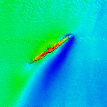
Mutibeam Digital Terrain Model (DTM) of uncharted wreck. |
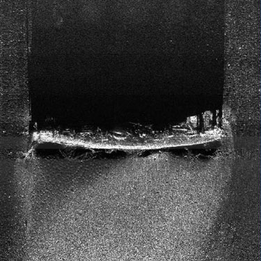
Side Scan Sonar image of unknown wreck. |
|
|