
 |
 |
 |
 |
 |
 |
 |
 |
 |
 |
 |
|
|
Ocean Color Data Sources
Research and monitoring programs are generally interested in live phytoplankton biomass and the suspended sediment concentration. For sediment concentrations, a measure of scatter provides the best information. At present, experimental backscattering alogorithms exist, however, additional work is necessary to validate these algorithms. As an alternative, using the remote sensing reflectance for bands that are most sensitive to scatter (and least sensitive to absorption) provides an estimate of the live phytoplankton biomass in the surface layer and is derived from the amount of water-leaving radiances at various wavelengths.
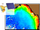
CoastWatch provides near real-time ocean color products, e.g. chlorophyll -a, with data from NASA's Earth Observing Satellites (EOS), Aqua and Terra, as well as GeoEye's Orbview-2 satellite (via contractual purchase). Each satellite specific product has unique characteristics dependent on the sensor and the algorithm applied.
 Recent Products Search Products |
Products: Chlorophyll-a with cloud mask / sun glint (MODOCL2A/B => HDF, GeoTIFF, PNG) Sensor: Moderate Resolution Imaging Spectroradiometer (MODIS) Spacecraft: NASA AQUA/TERRA (EOS AM-1/PM-1) Distribution: CoastWatch Home Page Registration Required? No More Information |
| NOAA CoastWatch provides near real-time MODIS ocean color products from the NASA Terra and Aqua spacecraft. Currently, imagery is supported within 24 hours of observation. More information on how CoastWatch implements MODIS data and NASA MODIS products can be found on the MODIS product page. | |
 CoastWatch Home Page Coastwatch Search |
Products: Ocean Color (chlorophyll-a, k_490, etc.) (PNG, GeoTIFF, HDF) Sensors: SeaWiFS Spacecraft: OrbView-2 Distribution: CoastWatch Home Page Registration Required? Yes. More information |
| Turbidity and Chlorophyll-a products are generated using NOAA developed algorithms from ocean color sensors. Data products produced using SeaWiFS data are restricted due to limitations associated with these commercial data. | |
|
|||||
|


