Weather Story
NWS Paducah, KY

Weather Stories from Neighboring Offices
Weather Story from the NWS office in St. Louis, MO Weather Story from the NWS office in Central Illinois Weather Story from the NWS office in Indianapolis, IN
Weather Story from the NWS office in Springfield, MO PAH Weather Story from the NWS office in Louisville, KY

Graphical depiction of the weather story for today.

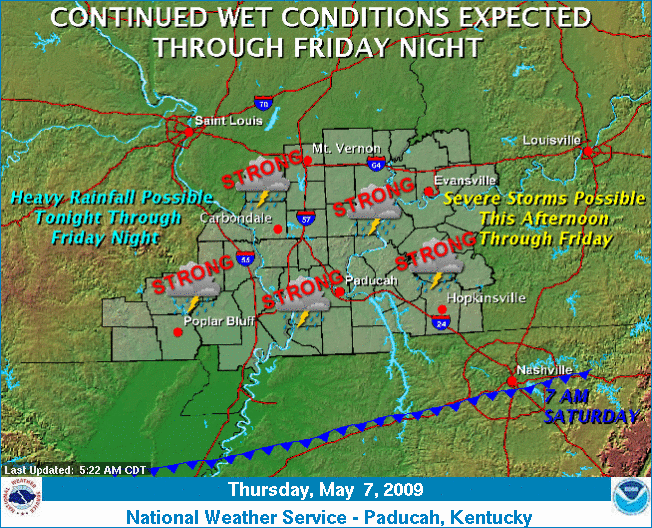
Widely scattered thunderstorms will likely develop this afternoon, with the potential for damaging winds, large hail and locally heavy rainfall. Later tonight, a complex of thunderstorms with the potential for damaging winds, and widespread heavy rainfall will move eastward into the quad state. Severe storms could re-develop ahead of this complex Friday, mainly across the southern half of the area. Widespread heavy rainfall will be possible Friday into Friday night as well. The precipitation chances will at least briefly come to an end late Saturday, as surface high pressure builds into the region, pushing a cold front well south of the area.

A Graphical Nowcast also is in effect.


  • National Weather Service
  • Paducah, KY Weather Forecast Office
  • 8250 Kentucky Highway 3520
  • West Paducah, KY 42086-9762
  • 270-744-6440
  • Page Author: PAH Webmaster
  • Web Master's E-mail: w-pah.webmaster@noaa.gov
  • Page last modified: Apr 27th, 2009 16:34 UTC
USA.gov is the U.S. government's official web portal to all federal, state and local government web resources and services.