| NOAA 2001-109 FOR IMMEDIATE RELEASE Contact: Susan A. Waever 11/2/01 |
|
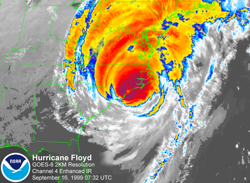
The National Weather Service, part of the Commerce Department's National Oceanic and Atmospheric Administration, began issuing five-day flood outlooks that identify areas at risk of significant river flooding Nov. 1. This product was tested by NOAA's River Forecast Centers for the past two months, and proved useful to emergency managers. "Over the past 50 years, flooding cost an average of 100 lives and almost $4 billion in damages per year in the United States – more than any other severe weather-related event," said John Jones, deputy director of the National Weather Service. "Flooding can result from any one, or a combination of too much rain, rapid snow melt, or floodwaters flowing downstream. The flood outlook product is an assessment of the likelihood of these factors, based on precipitation forecasts, snow cover and forecast temperature patterns." The flood outlook is developed by each of the 13 regional River Forecast Centers throughout the United States, and is available to the public with a graphical display on the Internet. An additional map showing flood potential for the contiguous 48 states will be available through the Emergency Managers Weather Information Network, NOAA Port, the Family of Services and NOAA Web sites. A prototype for this product was developed by the Southeast River Forecast Center to help warn communities of major flooding that resulted from Hurricane Floyd two years ago. "We want to give our users enough warning to help save lives and minimize property damage," said John Feldt, chief hydrologist for the center. "This new graphical product will give us a unique opportunity to provide a longer term outlook that will enable the public to prepare for potential flooding." The weather service began the first operational testing stage of this product for the coastal states from Texas to New Jersey in September 2001. In October 2001, the second test phase was conducted, with all 13 River Forecast Centers providing five-day flood outlooks for their areas of responsibility on their respective Web sites. The 13 different River Forecast Centers throughout the United States enable the weather service to focus on locally unique hydrologic conditions, including the potential impact of future precipitation on river levels. During the winter, the effects of river ice, ice jams and snowmelt will be considered as well. NOAA's National Weather Service is the primary source of weather and flood forecasts and warnings for the United States and its territories. NWS operates the most advanced weather and flood warning and forecast system in the world, helping to protect lives and property and enhance the national economy. To learn more, please visit http://www.nws.noaa.gov. For more about the product and links to
the new flood outlooks visit either site: http://www.nws.noaa.gov/oh/hic/Flood_Outlook/index.html |