weather.gov
Home
News
Organization
Search
Search by city or zip code. Press enter or select the go button to submit request
Local forecast by
"City, St" or "ZIP"
Alternate versions
Text-only
|
PDA
|
Cell
Get Storm Info
Satellite
|
Radar
Aircraft Recon
Advisory Archive
Experimental
Mobile Products
E-mail Advisories
Audio/Podcasts
GIS Data
|
RSS
Help with Advisories
Marine Forecasts
Atlantic and E Pacific
Analysis Tools
Help with Marine
Hurricane Awareness
Be Prepared
|
Learn
Frequent Questions
AOML Research
Hurricane Hunters
Saffir-Simpson Scale
Forecasting Models
Eyewall Wind Profiles
Glossary/Acronyms
Storm Names
Breakpoints
Hurricane History
Seasons Archive
Forecast Accuracy
Climatology
Most Extreme
About the NHC
Mission and Vision
Personnel
|
Visitors
NHC Virtual Tour
Library
Joint Hurr Testbed
The NCEP Centers
Contact Us
–
Help
TAFB Analysis Tools
TAFB Forecasts
|
Tools
|
Radiofax
|
NWS Marine Forecasts
|
NWS Weather Charts
|
Comments
Graphical Products
Atlantic
East Pacific
Hovmöller Diagram
(5 day Satellite)
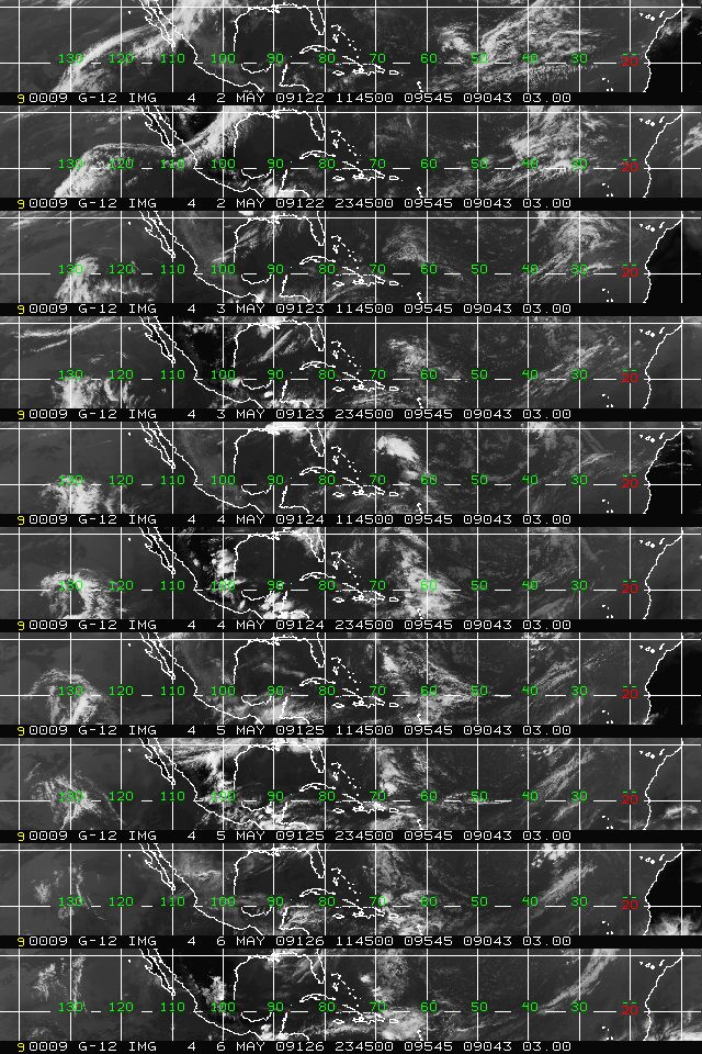
Tropical Atlantic and Caribbean (GOES-E)
Gulf of Mexico and subtropical Atlantic
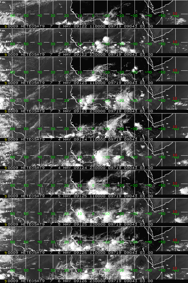
Eastern Atlantic and Africa (METEOSAT-9)
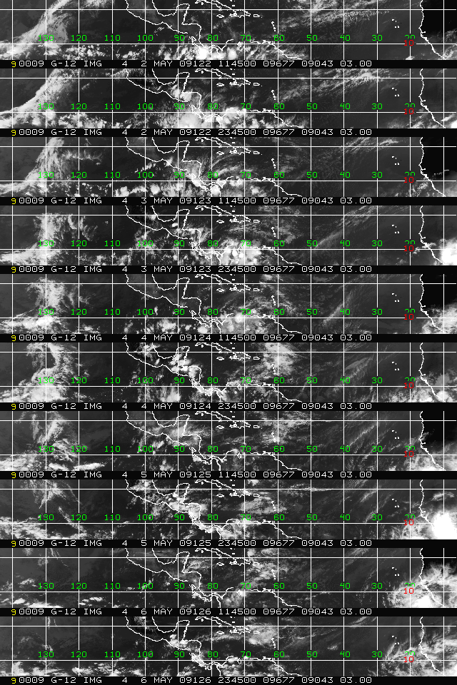
Southern CONUS
and subtropical
Atlantic (GOES-E)
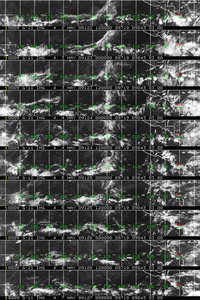
East Pacific (GOES-W)
Upper-Air Time Sections
Selected Observing Stations
Quikscat Ocean Wind Data
Recent Data
Streamlines
Please read changes to available data
Sea Surface Temperature
Analysis and Anomalies
TAFB Publications and External Resources
Quick Navigation Links:
NHC Active Storms
-
Atlantic and E Pacific Marine
-
Storm Archives
Hurricane Awareness
-
How to Prepare
-
About NHC
-
Contact Us
NOAA/
National Weather Service
National Centers for Environmental Prediction
National Hurricane Center
Tropical Prediction Center
11691 SW 17th Street
Miami, Florida 33165-2149 USA
nhcwebmaster@noaa.gov
Disclaimer
Credits
Information Quality
Glossary
Privacy Policy
Freedom of Information Act (FOIA)
About Us
Career Opportunities
Page last modified: Monday, 09-Feb-2009 00:23:29 GMT


