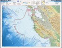
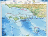
West Coast Region
The West Coast Regional office of the national marine sanctuaries manages 12,682 square miles of marine protected areas around the Channel Islands, Cordell Bank, Gulf of the Farallones, Monterey Bay and Olympic Coast. Each of our five west coast national marine sanctuaries is a jewel unto itself. Yet each of our sanctuaries is intimately connected not only with the others, but also to the entire coast from Alaska to Baja and to the far reaches of the world ocean via ocean currents.
The links on this page will take you on a tour of the west coast sanctuaries where you will discover more exciting news about the work we do to keep our marine sanctuaries safe and thriving. For additional information, including videos and still images, about the amazing natural resources protected by these sanctuaries, visit the Encyclopedia of the National Marine Sanctuaries.
West Coast Field Guide
The West Coast Field Guide introduces you to the natural and cultural wonders of your national marine sanctuaries. The California current, many marine species, and historic ocean uses all connect these sanctuaries to each other, and to the human communities on the west coast. To view an electronic version of the West Coast Field Guide, click here.
Maritime Heritage
The West Coast Region seeks to support research into human connections to the sea that include indigenous native cultures, seafaring traditions and the discovery and protection of maritime heritage resources. Today indigenous people continue their seafaring cultural activities that include building traditional watercraft and traversing sanctuary waters. Maritime heritage resources such as shipwrecks, and those objects which remain in place to remind us of historic activities such as lighthouses, historic wharves, docks and piers, populate the coastline from the State of Washington to California. Please visit the West Coast Region's maritime heritage webpage for more information.
Ocean Observations in West Coast Sanctuaries
The West Coast Observations network is comprised of 36 instrumented mooring arrays located at long term monitoring or sentinel sites within the five sanctuaries. The moorings collect information on ocean temperature at multiple depths. In certain locations, current speed and direction, oxygen, salinity, turbidity, and fluorescence along with meteorological information is also collected. Access the archived mooring data directly.
In addition to fixed moorings, the sanctuary program's sister vessels R/V Fulmar and R/V Shearwater, collect and transmit oceanographic and meteorological data in near real time. See an interactive map of the latest vessel locations and recent data reports.
The information from these platforms is archived in an IOOS compatible format and is fed into the NOAA-wide PaCOOS project which will help decision makers with resource management authority, including the sanctuary program, in the California Current Large Marine Ecosystem.
Management Plans
Management plans are site-specific documents that the Office of National Marine Sanctuaries uses to manage individual sanctuaries. Management plans:
- articulate visions, goals, objectives, and priorities for
an individual sanctuary;
- summarize existing programs and regulations;
- guide preparation of annual operating plans;
- guide management decision making;
- ensure public involvement in management
processes; and
- contribute to attaining national system goals and
objectives.
The ONMS is required to review management plans on a periodic basis. The four California national marine sanctuaries have recently completed the management plan review (MPR) process, while the Olympic Coast NMS has recently begun the MPR process. For information on the jointly conducted MPR process for the Cordell Bank, Gulf of the Farallones, and Monterey Bay national marine sanctuaries, including all associated final documents.
For information on the MPR at the Channel Islands NMS, click here.
And, for information on the Olympic Coast NMS MPR, click here.
LiMPETS
LiMPETS (Long-term Monitoring Program and Experiential Training for Students) is an environmental monitoring and education program for students, educators, and volunteer groups throughout California. As part of this network, teachers and students collect rocky intertidal and sandy beach data.
Ocean Etiquette
The west coast sanctuaries are renowned for their abundance of wildlife and it is important we know how to properly interact with that wildlife. Please visit the Ocean Etiquette website for general marine wildlife viewing guidelines that help promote safe wildlife viewing.
Thank You Ocean
The ocean is vital to life and touches us every day. The ocean gives so much to California: food, water, commerce, recreation, and the opportunity for quiet contemplation. Even medicines that heal us and the air we breathe come from the ocean. Yet, today the ocean is in trouble. Our ocean faces threats of pollution, marine debris, endangered populations, beach erosion, and more.
You can help. By learning about the ocean, getting involved in ocean activities and voicing your opinion to lawmakers, you can join the millions of Californians who are saying, "Thank You, Ocean!"

WCRO Contact Information:
West Coast Regional Office
99 Pacific Street, Bldg. 200, Suite K
Monterey, CA 93940
(831) 647-1920
(831) 647-1732 Fax
|