HOME | ABOUT US | CONTACT | REGIONAL MANAGERS
 
  Nautical Charts & Pubs  
 
  Nautical Charts & Products  
     •   Traditional Paper Charts  
     •   Print-on-Demand Charts (POD)  
     •   Raster Navigational Charts: NOAA RNCs  
     •   Electronic Navigational Charts: NOAA ENCs®  
     •   PocketCharts  
     •   BookletChart™ (Experimental)  
     •   Chart Updates (LNM and NM Corr'ns)  
 
  Nautical Charting Publications  
     •   United States Coast Pilot®  
     •   U.S. Chart No. 1  
     •   Chart Catalogs  
     •   Dates of Latest Editions (DOLE)  
     •   Upcoming New Editions (SON)  
 
  Nautical Charting Utilities  
     •   NOAA's On-Line Chart Viewer  
 
  Historical Products  
     •   Historical Maps and Charts  
     •   Historical Coast Pilots  
 
  Learn About Charting Products  
     •   Obtain Charting Products  
     •   How a Chart is Updated  
     •   Differences Between Maps & Charts  
     •   Learn About Nautical Charts  
     •   DGPS & Your Chart  
     •   Differences Between NM and LNM  
     •   Differences Between RNCs and ENCs  
     •   Differences Between NOAA ENCs® and DNCs®  
     •   Differences Between ENC and ENC®Direct to GIS  
 
  Data Portals  
     •   Tides and Currents (General)  
     •   nowCOAST: Real-Time Coastal Data Map Portal  
     •   Physical Oceanographic Real-Time System (PORTS)  
     •   Nautical Charting Links  
 
  Resources  
     •   Coast Survey Partners  
     •   Chart Carriage Requirements  
     •   Report a Charting Discrepancy  
     •   Chart Inquiries (questions/comments)  
     •   Cartographic Automation  
     •   Nautical Chart Calendars  
 

Raster Navigational Charts: NOAA RNCs
Raster navigational chart NOAA Raster Navigational Charts® (NOAA RNCs) are full-color digital images of NOAA's entire suite of paper charts. NOAA provides weekly updates to the RNCs, which are available for free on this site in the BSB format. NOAA RNCs are official data that can be used in many types of electronic charting systems, including Raster Chart Display Systems (RCDS) and Electronic Chart Display and Information Systems (ECDIS).

Raster Files
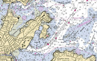
Raster files consist of a grid of different-colored pixels (dots). When the pixels are taken all together, they make up a digital image. Each pixel in a raster file is either turned on (you see a dot of color) or turned off (you see a white dot). The pattern of the dots makes up the shape of the features on the chart; the pixels that are turned off make up the white space. If you zoom into a raster chart, you will see all the individual pixels, but the image will become fuzzy and illegible. 

NOAA Raster Navigational Charts
NOAA RNCs are geo-referenced, digital images of NOAA navigational charts. Because the images are geo-referenced, you can display your vessel’s position on the chart image if you have a computer-based navigation system that is connected to a Global Positioning System (GPS).

NOAA updates the RNCs weekly; the updates are developed according to the standard set by the International Hydrographic Organization Special Publication S-61. (A link to these RNC product specifications is listed in the resources section above.)

RNCs downloaded from this site are official NOAA RNCs and may satisfy chart carriage regulations where permitted by the Code of Federal Regulations. Note: Current regulations do not support the use of RNCs for primary navigation when used independently of Electronic Navigational Charts (ENCs) and without up-to-date paper charts as a backup.

Raster Chart Display Systems
RCDS is a general term for navigation information systems that use official raster data, such as NOAA RNCs. RCDSs have three main components: raster navigational charts, a GPS receiver, and charting software.

RCDSs are an integrated navigational tool, providing functions such as: 
    • Voyage planning,
    • Waypoint and route monitoring,
    • Bearing and distance calculations, 
    • Subdued night colors, and 
    • Real-time positioning (that is, the ability to use a familiar chart image to instantly show a vessel’s position in relation to its charted surroundings).


Free Demo Software
You can obtain free RNC demo software at the following sites:

   •   Global Navigation Software Co
   •   Maptech Raster Chart Software
   •   The CAPN Raster Chart Software
   •   GPSNavX
   •   Rose Point
   •   Fugawi Marine ENC Software
   •   Caris Easy ENC
   •   SeaClear

Privacy Policy  |  Disclaimer  |  NOAA's National Ocean Service  |  NOAA  |  U.S. Department of Commerce