|
|
One of NOAA’s goals is to support the nation’s commerce with information for safe, efficient, and environmentally sound marine transportation. While this goal encompasses all forms of transportation, including air and surface, ocean travel and related commerce offer a particular set of challenges. Accurate and current nautical charts, tide and current observations, weather forecasts, and other NOAA environmental information are important for making sea travel much safer. Also important is ensuring that port operations and development and marine transit proceed efficiently and in an environmentally sound manner. Coastal and ocean information and services including reduced risk of marine accidents and oil spills, enhanced search and rescue capabilities, and other efficiencies from improved navigation could be worth $300 million dollars annually to the nation’s coasts. The mandate to create nautical charts of the nation's coasts dates back to 1807, when President Thomas Jefferson ordered a survey of the young nation's coast. The Organic Act of 1807 authorized the newly formed coastal survey agency to construct and maintain the nation's nautical charts. This agency, then known as the U.S. Coast Survey, is the oldest scientific organization in the United States. It has been a part of NOS since 1970, when the National Oceanic and Atmospheric Administration (NOAA) was created. The mandate to create and maintain nautical charts and related hydrographic information is meant to ensure safe navigation of maritime commerce within the U.S. Exclusive Economic Zone—an area of 3.4 million square nautical miles offshore from the coastline. Office of Coast Survey's Activities
Nautical Charts and Coast Pilots Today, the Office of Coast Survey (OCS) remains the primary agency responsible for constructing and maintaining the nation's suite of nautical charts. Nautical charts contain information about the nature and form of the coast, the depths of the water and general character and configuration of the sea bottom, locations of dangers to navigation, the rise and fall of the tides, locations of navigation aids, and characteristics of the Earth's magnetism. Nautical charts are available in paper format, in a raster format (georeferenced digital pictures of paper nautical charts), and in vector format. The United States Coast Pilot® consists of a series of nautical books that cover a variety of information important to navigators of coastal and intracoastal waters and the Great Lakes. Issued in nine volumes, Coast Pilots contain supplemental information that is difficult to portray on a nautical chart. Coast Pilots include channel descriptions, anchorages, bridge and cable clearances, currents, tide and water levels, prominent features, pilotage, towage, traffic separation schemes, small-craft facilities, and federal regulations that are applicable to navigation. Coast Pilots are available online for download. Hydrographic Data To produce the nation's nautical charts and ensure safe navigation in U.S. waters and Exclusive Economic Zone, OCS conducts hydrographic surveys to measure the depth and bottom configuration of water bodies. In collecting hydrographic data, particular attention is paid to acquiring the precise location of least (shoalest) depths on dangers to navigation and depths significant to surface navigation. The precise locations of aids to navigation are also emphasized and tide or water level measurements are also recorded to provide a vertical reference (Mean Lower Low Water) for water depths. Hydrographic surveys identify sea-floor materials, dredging areas, cables, pipelines, wrecks and obstructions, piles, and fish habitats using multibeam and side scan sonar tools. Ongoing research and development efforts aim to improve NOS's marine navigation products and services. NOS's Navigation Response Teams conduct hazardous obstruction surveys and emergency response. Working from 10 strategically placed offices, the teams are available on short notice and use dive operations, electronic navigation data collection, and mapping support capabilities to promote safe navigation in emergency situations 365 days a year throughout U.S. waters.
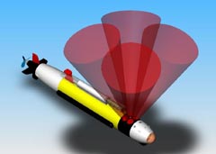
Autonomous Underwater Vehicles for Sea-bed Mapping To support nautical charting and hydrographic data collection efforts, OCS is evaluating Autonomous Underwater Vehicles (AUVs) to more efficiently and accurately acquire hydrographic data for shallow-water hydrographic surveys. AUVs are unmanned, self-contained robotic submersibles that perform their missions without direct human control, so they can conduct surveys covering large areas not suitable for traditional shipboard surveying techniques.
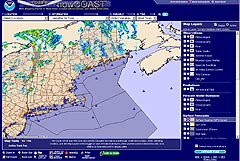
Geographic Information Systems Products and Services OCS is developing additional software and tools to disseminate nautical chart and hydrographic data on the Internet. ENC Direct to GIS allows users of geographic information system (GIS) software to acquire and incorporate data from OCS's Electronic Navigational Charts into their GIS systems. A suite of digital datasets and software products related to charting and bathymetry has been made available to support the coastal GIS community. OCS also makes available more than 21,000 historical maps and charts dating back to the late 1700s. The collection includes the nation's earliest nautical charts, hydrographic surveys, topographic surveys, geodetic surveys, city plans, and Civil War battle maps. OCS also maintains NOAA's nowCoast, an Internet mapping portal to real-time weather, ocean, river- and water-quality observations, and NOAA forecasts for U.S. coastal regions and the Great Lakes.
|
Educational Resources
|
|||||||||||||||||||||||
- NOS Program Offices
- Center for Operational Oceanographic Products and Services
- National Centers for Coastal Ocean Science
- NOAA Coastal Services Center
- National Geodetic Survey
- Office of Coast Survey
- Office of National Marine Sanctuaries
- Office of Ocean and Coastal Resource Management
- Office of Response and Restoration

Revised November 01, 2007
| Questions, Comments? Contact Us | Report
Error | Disclaimer | About
the Site | User Survey
National Oceanic and Atmospheric
Administration | U.S.
Department of Commerce | USA.gov
http://oceanservice.noaa.gov/topics/navops/marinenav/welcome.html


