Pollutants in the Environment
Emergency Response
Pollutants in the Environment
Serving Communities
Natural Resource Restoration

Information for:
Emergency Responders
Students and Teachers
Interested Public
Research Institutions
Other Agencies

Current News
Special Note
FAQs

Catalogs of:
Publications
Software & Data Sets
Web Portals
Links
Downloads
Image Galleries
Abandoned Vessels
Drift Card Studies

About OR&R
Contact Us
Advanced Search
Site Index
Privacy Policy
Document Accessibility

Pollutants in the EnvironmentHome | Image Galleries | Pollutants in the Environment

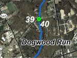
Dogwood Run GPS Locations 39 and 40

Locations 39 and 40 are where Dogwood Road crosses Dogwood Run at a bridge.  At this location, there is good riparian cover on the left bank downstream and a residential property on the right bank.  On the upstream side there are residential properties on both banks for 30 m (100 feet) or so and then the riparian zone transitions to forest cover.  English ivy was noted on the right upstream bank.  Dogwood Run was approximately 4.5 m (15 feet) wide and straight in this reach.  A riffle was visible in the distance upstream and there were cobbles in a bar downstream, less than one foot above the active low-flow channel.  The road crosses Dogwood Run in a single span bridge that does not impede fish passage.  There was algae in the creek and more trash in the creek than in most areas the team had visited in the watershed.

Click on an image below to see the full image.

Locations 39 and 40 - Aerial View

Locations 39 and 40 - Aerial View
(11.30.99, Dogwood Run)

Location 40 - Looking downstream at Dogwood Run from Dogwood Road bridge

Location 40 - Looking downstream at Dogwood Run from Dogwood Road bridge
(11.30.99, Dogwood Run)

Location 40 - Looking upstream at Dogwood Run from Dogwood Road bridge

Location 40 - Looking upstream at Dogwood Run from Dogwood Road bridge (1 of 2)
(11.30.99, Dogwood Run)

Location 40 - Looking upstream at Dogwood Run from Dogwood Road bridge

Location 40 - Looking upstream at Dogwood Run from Dogwood Road bridge (2 of 2)
(11.30.99, Dogwood Run)

Location 40 - Dogwood Road bridge from Dogwood Run

Location 40 - Dogwood Road bridge from Dogwood Run (1 of 2)
(11.30.99, Dogwood Run)

Location 40 - Dogwood Road bridge from Dogwood Run

Location 40 - Dogwood Road bridge from Dogwood Run (2 of 2)
(11.30.99, Dogwood Run)

Related Pages on Our Site
NOAA logo