Pollutants in the Environment
Emergency Response
Pollutants in the Environment
Serving Communities
Natural Resource Restoration

Information for:
Emergency Responders
Students and Teachers
Interested Public
Research Institutions
Other Agencies

Current News
Special Note
FAQs

Catalogs of:
Publications
Software & Data Sets
Web Portals
Links
Downloads
Image Galleries
Abandoned Vessels
Drift Card Studies

About OR&R
Contact Us
Advanced Search
Site Index
Privacy Policy
Document Accessibility

Pollutants in the EnvironmentHome | Image Galleries | Pollutants in the Environment

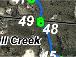
Mill Creek GPS Locations 48 and 49

Locations 48 and 49 are where US 40 crosses over the south tributary of Mill Creek.  The creek is relatively straight and slow-moving upstream of the highway, and passes under the road through a rectangular culvert.  Water in the creek was iron-stained and algae was observed.  The creek passes through a forested area that provides a full riparian buffer.  The creek bed is sand and gravel.  Downstream of the highway, the apron of the culvert drops approximately one foot to a pool.  This drop could be a fish passage obstruction, although beaver dams downstream (as described at locations 45 and 46) may preclude migratory fish from this location.  A downed tree straddled the creek a few feet downstream of the culvert apron.  The creek banks are 0.5 to 1 m (2 to 3 feet) high below the highway, which may indicate downcutting.  The riparian vegetation is a good mix of trees and shrubs.  There was evidence of repairs to the highway embankment on the left downstream bank, which suggests that highway runoff overwhelms the capacity of the stormwater system or that the discharge in Mill Creek is periodically too high for the culvert.

Click on an image below to see the full image.

Locations 48 and 49 - Aerial View

Locations 48 and 49 - Aerial View
(11.30.99, Mill Creek)

Location 48 - North side of US 40 looking at the Mill Creek box culvert

Location 48 - North side of US 40 looking at the Mill Creek box culvert
(11.30.99, Mill Creek)

Location 48 - North side of US 40 looking upstream from the Mill Creek box culvert

Location 48 - North side of US 40 looking upstream from the Mill Creek box culvert
(11.30.99, Mill Creek)

Location 48 - North side of US 40 and Mill Creek showing pool of iron-stained water

Location 48 - North side of US 40 and Mill Creek showing pool of iron-stained water
(11.30.99, Mill Creek)

Location 49 - South side of US 40 and Mill Creek with 6- and 12-in. drop (fish blockage)

Location 49 - South side of US 40 and Mill Creek with 6- and 12-in. drop (fish blockage) (1 of 2)
(11.30.99, Mill Creek)

Location 49 - South side of US 40 and Mill Creek with 6- and 12-in. drop (fish blockage)

Location 49 - South side of US 40 and Mill Creek with 6- and 12-in. drop (fish blockage) (2 of 2)
(11.30.99, Mill Creek)

Location 49 - Rhododendron - prob. Rhododendron canescens (mountain azalea)

Location 49 - Rhododendron - prob. Rhododendron canescens (mountain azalea)
(11.30.99, Mill Creek)

Location 49 - Down-cutting in bank of Mill Creek downstream of US 40

Location 49 - Down-cutting in bank of Mill Creek downstream of US 40
(11.30.99, Mill Creek)

Location 49 - Mill Creek looking downstream from US 40

Location 49 - Mill Creek looking downstream from US 40 (1 of 2)
(11.30.99, Mill Creek)

Location 49 - Mill Creek looking downstream from US 40

Location 49 - Mill Creek looking downstream from US 40 (2 of 2)
(11.30.99, Mill Creek)

Related Pages on Our Site
NOAA logo