Cooperating Technical Partners (CTP) Success Stories
The Federal Emergency Management Agency’s (FEMA) Cooperating Technical Partners (CTP) Program is an innovative approach to creating partnerships between FEMA and participating NFIP communities, regional agencies, State agencies, tribes, and universities that have the interest and capability to become more active participants in the FEMA flood hazard mapping program. Several of our partners have made noteworthy achievements. They have developed innovative ideas that have helped them work more efficiently to hit major milestones. FEMA has highlighted these partners' achievements and innovations in what we are calling our CTP “Success Stories”.
Flood Control District of Maricopa County, Arizona (FCDMC)
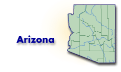
Maricopa County has experienced recent and rapid development. The FCDMC staff converted FIRM and FIS into digital format using orthophotos for the base map and incorporated Letters of Map Revision into the map (credited under CRS Activity 440 - Flood Data Maintenance). The District’s proaction has resulted in more accurate mapping of the flood zones in the county, and a reduction in flood insurance premiums for some residents in Special Flood Hazard areas. Complete Story
Colorado Water Conservation Board (CWCB)

The CWCB has partnered with the Urban Drainage and Flood Control District (UDFCD), a regional CTP partner, on floodplain studies in the Denver Metropolitan area. Both partners are participating actively in the preparation of high-quality floodplain mapping and are producing countywide Digital Flood Insurance Rate Maps (DFIRMs). CWCB prepared new and revised maps to show the effects of increased flood hydrology following large-scale wildfire events, development and growth in previously unstudied areas, and changes in engineering and mapping technology. Additionally, the CWCB has published a Statewide Floodplain and Stormwater Criteria Manual that provides much needed technical guidance for flood-related studies in Colorado. Complete Story
Southwest Florida Water Management District (SWFWMD)
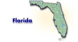
The SWFWMD is a CTP working closely with Hernando County and the Board of County Commissioners on a multi-year project to re-examine flood zones throughout the county and develop detailed, digital flood hazard maps to replace the existing outdated maps. Complete Story
Georgia Department of Natural Resources (DNR)
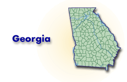
Georgia has one of the highest numbers of counties in the nation and is the largest state east of the Mississippi, so specialized techniques are required to scope flood map production. The State of Georgia has assumed end-to-end responsibility for Flood Map Modernization within the state, and has developed a special regionally-based scoping process, calling on the resources of the sixteen Regional Development Centers (RDCs) within the state. Complete Story
Illinois Department of Natural Resources (DNR)
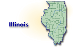
The Illinois Department of Natural Resources collaborated with the Illinois State Water Survey to not only map Cook County, Illinois, the second most populated County in the U.S., but also to complete this effort only three years after initially signing the Memorandum of Agreement to join the CTP Program. Complete Story
University of Maryland

The University of Maryland has worked closely with the Maryland Department of the Environment, a Cooperating Technical Partner, to create hydrologic flood models by using Light Detection and Ranging (LiDAR) data collected by the university. The university was asked to assess and evaluate how useful the data could be in the creation of the DFIRMs, and assigned students to improve data layers in the field by verifying the presence of structures that were obstructing or limiting the data, and to obtain other data layers such as State Highway GIS. Benefits of this project included the students’ exposure to both the theory and application of these tools and the opportunity to explore career possibilities.
University of New Hampshire Success Story
Universities currently represent approximately 2 percent of CTPs. In 1999, the University of New Hampshire became the first university to become a CTP. The Complex Systems Research Center at the University of New Hampshire is a well-established information resource for government agencies, nonprofit organizations, and communities. Complete Story
Mecklenburg County, NC Storm Water Services (SWS)

The District’s staff converted the FIRM and FIS into digital format, using orthophotos for the base map, and incorporated Letters of Map Revision into the map (credited under CRS Activity 440 - Flood Data Maintenance). The District’s proaction resulted in more accurate mapping of the flood zones in the county, and a reduction in flood insurance premiums for some residents in Special Flood Hazard areas. Complete Story
North Carolina State Review of Requests for CLOMRs and LOMRs
For the past six years, North Carolina has been at the forefront of an ongoing effort to expand the involvement of state, regional, and local government agencies in managing the nation's floodplain maps. In the year 2000, the State of North Carolina signed a CTP agreement with the Federal Emergency Management Agency, through which North Carolina became the first Cooperating Technical State in the country. Under that agreement, the State initiated its program to create updated digital Flood Insurance Rate Map panels for the entire State. Complete Story
North Carolina Floodplain Mapping Program
In 2000, the NCFMP signed an agreement with the Federal Emergency Management Agency (FEMA) and became the first Cooperating Technical State (CTS) in the nation. On September 5, 2008, the North Carolina Floodplain Mapping Program (NCFMP) issued preliminary Flood Insurance Rate Maps (FIRMs) to its 100th county, completing the first pass at providing new, improved flood hazard data to the entire state. The NCFMP partnered with other federal and State agencies to succeed in their mission to provide seamless statewide mapping using the most up-to-date data available. Being the first entity to attempt statewide mapping meant the NCFMP had to be innovators in nearly all aspects of producing a Flood Insurance Study from scoping all the way through to effective issuance. Complete Story
North Central Texas Council of Governments (NCTCOG)
NCTCOG has put a framework into place for coordinated and focused hazard mitigation actions at both the local and regional levels. NCTCOG has a long history of working with State and Federal agencies, most prominently the U.S. Army Corps of Engineers, to address hydrologic issues along the Trinity River. Complete Story
Temple University, Philadelphia, PA
The Center for Sustainable Communities has been a Cooperating Technical Partner since 2003, and has been involved with two CTP Flood Map Modernization projects. The first project involved alleviating flooding and pollution in the Pennypack Creek Watershed. The second project the CSC is undertaking is a 14-month study to model flooding problems in the Sandy Run and Ambler Area Watersheds in order to prepare new floodplain maps for submission to FEMA.
King County, Washington
King County is working on a new flood study for the Green River and has completed a study of portions of the Snoqualmie and Skykomish Rivers in King and Snohomish Counties. As the Nation’s highest-rated county under the CRS program and second-highest-rated community overall, King County has been a long-time supporter and innovator under the CRS program. Complete story
West Virginia University
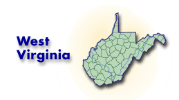
The West Virginia GIS Technical Center has created new base layers and stream data, has incorporated new high-resolution data, and is currently uploading this information into FEMA’s Mapping Information Platform. The Center hopes to produce updated DFIRMs for the entire State by next year.
Last Modified: Tuesday, 17-Mar-2009 11:05:57 EDT
