Water Resources of Minnesota
Welcome to the USGS Minnesota Water Science Center. These pages are your source for water-resource information collected and interpreted by the U.S. Geological Survey in Minnesota.
Minnesota Water Science Center activities include:
- Presentation of real-time streamflow, water-quality, ground-water levels data.
- Operation and oversight of an extensive network of water-resource monitoring sites.
- Archive of water-resource information collected for more than 100 years.
- Data collection and investigative studies related to issues of concern to water-management entities and citizens.
- Publishing data and topical reports.
Quick Link to Real-Time Data:
View site list: SW | GW | WQ
MinnesotaMonitoring Networks
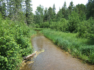
The USGS Minnesota Water Science Center continuously monitors surface water, ground water, and water quality parameters across the state. Monitoring sites are operated in cooperation with various local, State, or Federal agencies.

Minnesota provides real-time water-stage, streamflow and precipitation data at 149 sites across the state.

33 ground-water wells are monitored by the USGS in Minnesota. These wells record data on hourly intervals.

Water-quality conditions are continuously monitored by the USGS at 11 sites across the state of Minnesota
Data via GoogleMaps
New Maps Deliver Current Streamflow Conditions
 We recently added a Google-Map based Web page to deliver map-based current surface-water resources conditions in Minnesota. We recently added a Google-Map based Web page to deliver map-based current surface-water resources conditions in Minnesota.
The maps utilize zoom and pan to allow you to focus in on the water-monitoring sites that interest you. The maps show current streamflow as compared to historical records. By hovering your mouse over a site, a popup box shows the most recent stage and streamflow.
Featured Publication
Occurrence of Endocrine Active Compounds and Biological Responses in the Mississippi River: Study Design and Data, June through August 2006. By Kathy E. Lee1, Christine S. Yaeger1, Nathan D. Jahns2 , and Heiko L. Schoenfuss2.
 This report was prepared in a joint effort between U.S. Geological Survey1 and St. Cloud State University2
Major Findings in the study include:
- Endocrine-active compounds are a class of chemicals that interfere with the natural regulation of endocrine systems, and they have been identified in surface waters worldwide. An understanding of their distribution in aquatic systems is important so that aquatic organism exposure can be evaluated.
- The U.S. Geological Survey, Minnesota Pollution Control Agency and St. Cloud State University collected water, bed sediment, and fish at 43 sites along the river from headwaters at Lake Itasca to 14 miles downstream from Brownsville, Minnesota during June to August 2006 as part of an integrated biological and chemical study of endocrine active compounds and endocrine disruption in fish in the Mississippi River.
- Endocrine active compounds and household, industrial, or agricultural wastewater indicator compounds were detected in water and bottom sediment samples from the Mississippi River. compounds were detected in bottom sediment samples (ranged from 3 to 31) than in water samples (ranged from 0 to 9).
- Cholesterol, atrazine, N,N-diethyl-meta-toluamide (DEET) metolachlor, and hexahydrohexamethylcyclopentabenzopyran (HHCB) detected most frequently in water samples.
- Indole, beta-sitosterol, cholesterol, beta-stigmastanol, 3-methyl-1H-indole, p-cresol, pyrene, phenol, fluoranthene, and 3-beta coprostanol, benzo[a]pyrene, acetophenone, and 2,6-dimethylnaphthalene were the most frequently detected in bottom sediment samples. The compounds NP1EO, NP2EO, and 4-nonylphenol were detected in greater than 10 percent of the bottom sediment samples.
|