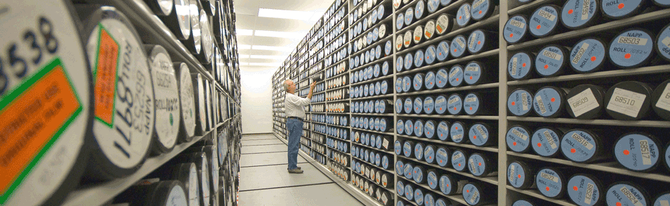
The Aerial Photography Field Office (APFO) is the primary source of aerial imagery for the United States Department of Agriculture. Over 10,000,000 images are held here. The imagery dates begin with 1955 to the present.
Custom photographic prints with various choices of attributes now available.
For more information and the limitations of this new service, please contact our Customer Service Section at apfo.sales@slc.usda.gov. For examples, click below.
To view more custom digital print samples, go to Imagery Products > then Custom Digital Print Samples under Related Topics.
To order custom digital prints click here for order form.
How APFO supports FSA with Geospatial Technology
View a Windows Media Video (.wmv), on how APFO has used and continues to use geospatial technology to facilitate and sustain the growth of FSA programs. To download the 46MB file, click here.
An MSWord document of the narration is available here.
Just a reminder
Our phone numbers have changed. To contact us, our main number is 801-844-2900. To contact the Customer Service Section (Sales), dial 801-844-2922. To fax aerial imagery orders or inquiries, dial 801-956-3653.
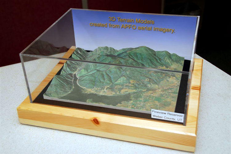
3D Terrain Model Using NAIP Imagery
NOTICE OF CHANGE February 23, 2009. APFO is temporarily pending any replies to inquires from anyone interested in physical 3D terrain models using NAIP imagery due to federal government single source referral policies. You may still contact the Customer Service Section at apfo.sales@slc.usda.gov to place a request for information but detailed replies will not be made until multiple sources have been determined for referrals. We apologize for any lengthy time periods without any detailed replies to previous inquires as we research entities that can provide physical 3D terrain modeling using NAIP imagery. Once the referrals have been determined, you will be contacted for additional information for APFO to produce the proper digital images and files needed. You may then make a selection from the referral list and forward the digital files to purchase a physical 3D terrain model. Thank you for your patience.


The Aerial Photography Field Office (APFO) has one of the largest collections of historical aerial photography in the nation.
To read information regarding APFO's collected works, click on either the DOC version or the PDF version for this article.
|