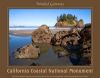
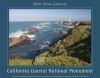
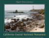
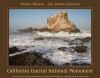
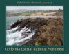
Located off the 1,100 miles of the California coastline, the California Coastal National Monument is comprised of more than 20,000 BLM administered small islands, rocks, exposed reefs, and pinnacles. The Monument includes those public lands that are exposed above mean high tide, within the corridor extending 12 nautical miles from the shoreline between Mexico and Oregon. Established by Presidential Proclamation number 7264 on January 11, 2000, to elevate the protection of “all unappropriated or unreserved lands and interest in lands owned or controlled by the United States in the form of islands, rocks, exposed reefs, and pinnacles above mean high tide within 12 nautical miles of the shoreline of the State of California.” the California Coastal National Monument is collaboratively managed with a wide variety of partners. These partners include other federal agencies, state and local governments; cooperating tribal organizations; select colleges and universities; and a variety of non-profit organizations. The primary purpose of the Monument is to protect the important geologic features and the unique habitat they provide for both terrestrial and marine plants and animals found within its boundaries. In addition, the proclamation recognizes the California Coastal National Monument as containing “irreplaceable scientific values vital to protecting the fragile ecosystems of the California coastline.” The offshore lands that constitute the Monument, totaling about 1,000 acres, provide sanctuary for many seabirds and marine mammals, as well as some of the most breathtaking scenery in California. |