
 Feeds & Data
ShakeMaps
ShakeMap is a product of the U.S. Geological Survey Earthquake Hazards Program in conjunction with regional seismic network operators. ShakeMap sites provide near-real-time maps of ground motion and shaking intensity following significant earthquakes. These maps are used by federal, state, and local organizations, both public and private, for post-earthquake response and recovery, public and scientific information, as well as for preparedness exercises and disaster planning.
Networks producing ShakeMaps
Click a network name to view a list of events, or on an image to view the event
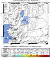
S California

10374021N California

51215576Pacific NW

01301325Nevada

2009007_271011Utah
1000001268Hawaii

00032954Alaska

88563Global

2009ckbk
Last 10 ShakeMaps from any Network
A list of all ShakeMaps is available in the ShakeMap Archive
| Mag | Name/Epicenter | Date | Time | Lat | Lon | Network | Event ID |
|---|---|---|---|---|---|---|---|
| 3.5 | ISLAND OF HAWAII, HAWAII | Jan 31 2009 | 05:17:06 UTC | 19.358 | -155.053 | Hawaii | 00032954 |
| 4.5 | 7.8 km ENE of Poulsbo, WA | Jan 30 2009 | 13:24:00 UTC | 47.772 | -122.557 | Pacific NW | 01301325 |
| 5.6 | ACRE, BRAZIL | Jan 29 2009 | 22:28:06 UTC | -8.111 | -71.284 | Global | 2009ckbk |
| 4.2 | 11.1 mi SE of San Clemente Is. (SE tip), CA | Jan 29 2009 | 08:41:59 UTC | 32.693 | -118.227 | S California | 10374021 |
| 5.5 | SAMOA ISLANDS REGION | Jan 28 2009 | 12:39:42 UTC | -16.969 | -172.079 | Global | 2009cja3 |
| 5.7 | KEPULAUAN ALOR, INDONESIA | Jan 28 2009 | 07:53:35 UTC | -8.955 | 124.137 | Global | 2009cjar |
| 5.7 | KEPULAUAN BATU, INDONESIA | Jan 28 2009 | 00:01:13 UTC | -0.228 | 98.294 | Global | 2009cjab |
| 5.5 | KOMANDORSKIYE OSTROVA, RUSSIA REGION | Jan 27 2009 | 23:57:11 UTC | 55.559 | 164.295 | Global | 2009cibq |
| 5.9 | FIJI REGION | Jan 27 2009 | 06:29:13 UTC | -17.823 | -178.694 | Global | 2009ciai |
| 5.6 | KEPULAUAN BATU, INDONESIA | Jan 26 2009 | 19:33:09 UTC | -0.294 | 98.193 | Global | 2009chbd |
