Active Ground-Water Level Network


Baker County, Georgia
Hover mouse over site for information. Click site to open page with information and data.

|Baker County, GEORGIA 1.                 Site: 311400084295502 - 10H009
Period of Record: 7/23/1998 - 1/17/2008
               Aquifer: UPPER FLORIDAN AQUIFER SYSTEM
                 Depth: 200
  Last data value: 44.54 on 1/17/2008
2.                 Site: 312617084110701 - 12K014
Period of Record: 4/29/1982 - 11/5/2008
               Aquifer: UPPER FLORIDAN AQUIFER SYSTEM
                 Depth: 137
  Last data value: 46.67 on 11/5/2008

Explanation of symbols on the state map.

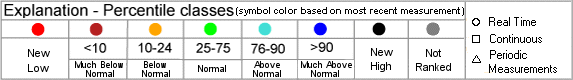
Map generated 11/7/2008 8:04:59 AM
Ground-Water Watch
Help Page
   Display
interactive map

Network wells depicted on the Baker County, GA location map
Note: Color shading in the table below indicates multiple wells that plot as a single point on the state location map above.
Note: BLS = Water Level in Feet Below Land Surface, RVD = Water Level referenced to a vertical datum
Map
Index
Site ID Site NameMost Recent
Measurement
DateWell
Depth
Local Aquifer
1 311400084295502 10H00944.54 BLS 1/17/2008  200    Upper Floridan Aquifer System
2 312617084110701 12K01446.67 BLS 11/5/2008  137    Upper Floridan Aquifer System


Accessibility FOIA Privacy Policies and Notices

Take Pride in America logo USA.gov logo U.S. Department of the Interior | U.S. Geological Survey | Water Resources Discipline | Office of Ground Water

URL: http://groundwaterwatch.usgs.gov/countymaps/GA_007.html
Page Contact Information: OGW Webmaster
Last update: Friday, November 07, 2008 at 08:05