Featured Topic
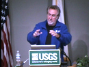 Online USGS Lectures Online USGS Lectures
USGS online lectures that are suitable for viewing by middle school, high school, and college- level students have been compiled onto a single Web site. Scientists give dynamic presentations on diverse topics that range from sea otters to nuclear waste to climate change. Each lecture is 60-90 minutes long.
Featured Topics Archive |
USGS Educational Resources For Primary Grades Grades K-6
USGS Educational Resources For Secondary Grades Grades 7-12
USGS Educational Resources For Undergraduate Education Community Colleges and Universities
USGS Resources For California's Education Standards (K-12)
This Web site links selected online resources to an established list of Science and History-Social Science content standards for California.
Schoolyard Geology
Activities and examples of ways to turn a "field trip" through your own schoolyard into a rich geologic experience.
The "GIS Lab"
Lessons, data, and information about using Geographic Information Systems (GIS) and spatial analysis in education.
The "GPS Class"
Lessons and information about using Global Positioning Systems (GPS) in education.
USGS Publications
Search database of over 69,000 USGS maps, books, and other publications.
USGS Store
Use the USGS Store to browse and purchase paper maps and other products that are popular with educators. Just enter the Store and click on "Education Products" (teacher discounts are available). Also download free digital topographic maps by clicking on "Map Locator".
USGS Photo and Image Collections
A comprehensive list of USGS photos and images for public use.
Ask USGS
Can't find the information you need? Send your question to Ask USGS or call 1-888-ASK-USGS (1-888-275-8747). For questions related to geology only, receive a personal response from a USGS scientist by contacting Ask-A-Geologist.
|
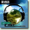 USGS Podcast Series USGS Podcast Series
USGS CoreCast audio files (4-15 minutes long) address topics ranging from natural hazards to human health and wildlife disease. Short on time but big on science? Listen to very brief audio files at USGS CoreFacts.
Educational Videos and Animations
A collection of USGS videos and animations covering a wide range of science.
Videotaped Lectures
A compilation of USGS videotaped lectures.
Find A Map!
Links to popular USGS map resources and map databases, including the: The National Map, and The National Atlas.
Our Changing Planet
Think that geography is just memorizing state capitals? With these USGS resources and lessons, you'll be investigating our changing planet!
Careers in Science
Web resources and videos about USGS Science and Careers.
Internships, Employment Opportunities, and Research Grants
See what opportunities are available for undergraduate and graduate students, and faculty to participate in USGS science. |

