
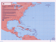
Atlantic Hurricane Tracking Chart
August 2008
North Atlantic Ocean, 1995
Enlarge
The Gulf of Mexico covers more than 700,000 square miles in Southeast North America. It is bordered by the coast of the United States from Florida to Texas and the East coast of Mexico from Tamaulipas to Yucatán.
The Caribbean Sea is approximately a 970,000 square mile arm of the Atlantic Ocean. It is bordered on the North and East by the West Indies archipelago, on the South by South America and on the West by the Central American Isthmus. The Caribbean has a counterclockwise current: water enters through the Lesser Antilles. Volcanic activity and earthquakes are common in the Caribbean, as are destructive hurricanes that originate over the sea or the Atlantic. The Gulf Stream current is formed from waters of both the Caribbean Sea and Gulf of Mexico.
On August 7th, 2008, National Oceanic and Atmospheric Administration (NOAA) projected an 85% probability of an above-normal season – up from 65% in May. NOAA’s Climate Prediction Center increased the likelihood of an above-normal hurricane season and raised the total number of named storms and hurricanes that may form.
Eight named storms formed already in the 2008 season. Tropical Storm Arthur affected the Yucatan Peninsula in late May and early June. Bertha was a major hurricane and the longest-lived July storm (July 3-20) on record. Tropical Storm Cristobal skirted the North Carolina coastline. Dolly made landfall as a Category 2 hurricane at South Padre Island, Texas on July 23. The fifth storm, Tropical Storm Edouard, struck the upper Texas coast on August 5th. While the sixth storm, Tropical Storm Fay, struck Florida August 15 - 26. As of August 29th, two additional named storms, Gustav and Hanna, have formed.
For more information on hurricanes in these regions, see the National Hurricane Center.
National Oceanic and Atmospheric Administration; National Hurricane Center, 200808; 2005
This map has also been used:
- North Atlantic Ocean, Caribbean Sea, August, 2005