|
| |
Flood Prevention Program (PL 78-534)

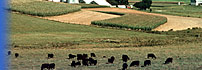
United States map showing the location of the eleven (11)
authorized flood prevention watershed projects.
Background
This Act authorized eleven flood prevention watersheds. The Natural Resources
Conservation Service (NRCS) and the Forest Service (FS) carry out this responsibility
with assistance from other bureaus and agencies within and
outside USDA.
Watershed protection and flood prevention work currently
underway in small upstream watersheds all over the United States
sprang from the exploratory flood prevention work authorized
by the Flood Control Act of 1944, Public Law 534 and from
the intervening 54 pilot watershed projects authorized by the
Agriculture Appropriation Act of 1953.
The eleven watershed areas are:
| Watershed Name |
State Location |
Watershed Size |
| Buffalo Creek |
New York |
279,680 Acres |
| Middle Colorado River |
Texas |
4,613,120 Acres |
| Coosa River |
Georgia, Tennessee |
1,339,400 Acres |
| Little Sioux River |
Iowa |
1,740,800 Acres |
| Little Tallahatchie River |
Mississippi |
963,977 Acres |
| Los Angeles River |
California |
563,977 Acres |
| Potomac River |
Virginia, W. Virginia, Maryland,
Pennsylvania |
4,205,400 Acres |
| Santa Ynez River |
California |
576,000 Acres |
| Trinity River |
Texas |
8,424,260 Acres |
| Washita River |
Oklahoma, Texas |
5,095,040 Acres |
| Yazoo River |
Mississippi |
3,942,197 Acres |
Because the authorized flood prevention projects include
relatively large areas, work plans are developed on a
sub watershed basis. As of September 30, 1998, the total planning
job was about 74 percent completed, with 320 work plans completed
that include 24,971,385 acres.
These documents require Microsoft Word Microsoft Word
Key
to Status Report of (P.L. 83-566) and (P.L. 78-534) Authorized Watershed
Projects (Includes one P.L. 639 project) as of October 1, 2000 (21.5 KB)
FY
2000 Status of P.L. 78-534 (147.8 KB)
< Back to Watersheds
| | |