|
|
|
 |
|
NRCS Home
|
|
|
|
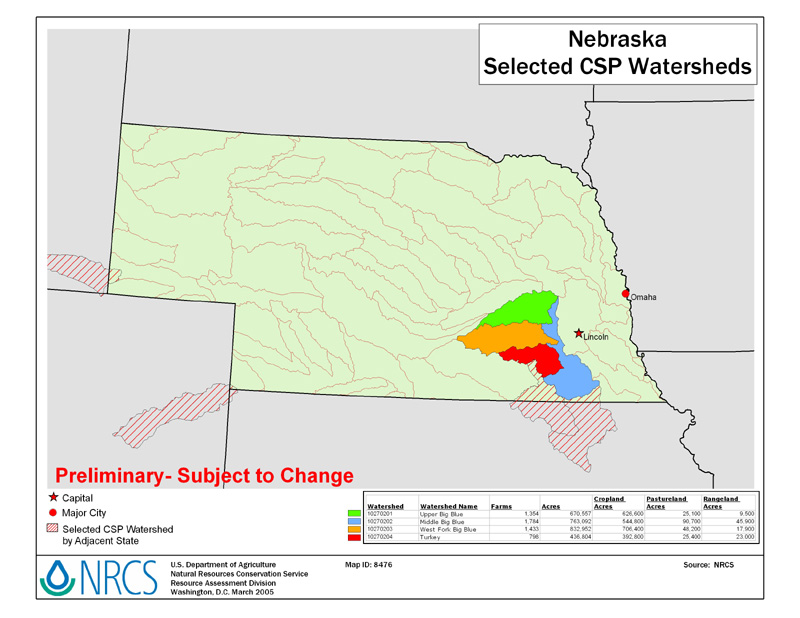
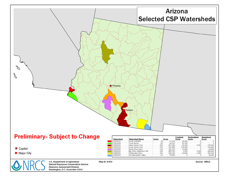
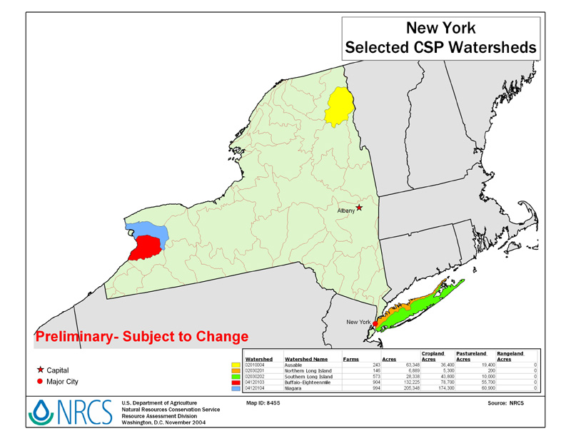
Conservation Security Program (CSP) Watersheds, FY-2005Updated 4/5/2005 For a more detailed State map, click on a State under "State Map" in the list below. For your watershed CSP sign-up information, click on the "State CSP Web Page" below.
Download U.S. CSP Watersheds - 2005 Map The data table is available in To print State maps, first save the map to your computer. FY-2005 CSP FactoidsIn FY 2005, the Conservation Security Program will touch… Combined, these watersheds include about 185 million acres, an area about the
size of Louisiana, Mississippi, Alabama, Georgia, South Carolina, and Florida
(which total 190.5 million acres). Overall, these farms and ranches help us meet our goal of offering CSP to
participants in all of our watersheds with working agricultural lands over the
next 8 years. |
|
|
