|
Precipitation Helps, but Still No Changes in Drought Situation |
||||||||||||||||||||||||||||||||||||||||||||||||||||||||||||||||||||||||||||||||||||||||||||||||||||||||||||||||||||||||||||||||||||||||||||||||||||||||||||||||||||||||||||||||||||||||||||
| Summary: | ||||||||||||||||||||||||||||||||||||||||||||||||||||||||||||||||||||||||||||||||||||||||||||||||||||||||||||||||||||||||||||||||||||||||||||||||||||||||||||||||||||||||||||||||||||||||||||
|
From 7 AM on December 2nd through 7 AM on December 9th, between a half and an inch and a half of precipitation less than a half inch of precipitation fell across northeast Iowa, southeast Minnesota, and the southern two thirds of Wisconsin. Meanwhile the remainder of the Upper Mississippi River Valley received less than a half inch. The greatest precipitation amounts during the aforementioned time period were reported at Prairie du Chien WI (1.25 inches), Richland Center WI (1.02 inches), Waukon IA (1.07 inches), La Crosse Municipal Airport (0.96 inches), Neillsville WI (0.94 inches), La Crescent Dam 7 MN (0.93 inches), and the National Weather Service office in La Crosse (0.92 inches). The map below provides more detail on how much precipitation fell across the area during this time period.
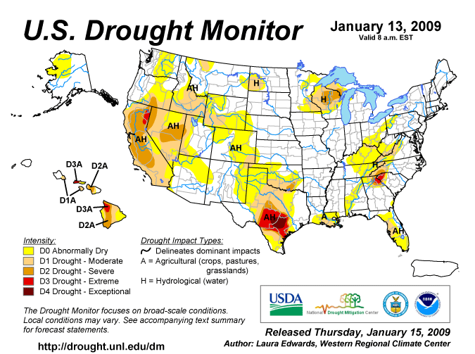
Typically, between a quarter and a third of an inch of precipitation falls during this time period, so there was some reduction in the precipitation deficits which have developed during the latter half of 2008. However this was not enough of a reduction to change the drought situation. In northeast Iowa, precipitation deficits are running between 2.50 inches and 6.50 inches since mid July 2008. These precipitation deficits have resulted in an abnormally dry (D0) and moderate drought (D1) conditions across this area. In southeast Minnesota, precipitation deficits are running between 5.50 and 9.50 inches since mid June 2008. These precipitation deficits have resulted in an abnormally dry (D0) and moderate drought (D1) conditions across this area. Finally, in western Wisconsin, precipitation deficits are running between 3.50 and 8.00 inches since mid July 2008. This has resulted in abnormally dry (D0) to severe drought (D2) conditions across these areas. The moderate (D1) to severe (D2) drought caused some reduction in the 2008 soy bean yields. This crop averaged 15 to 30 bushels per acre. Normally, these yields should have ranged from 35 to 45 bushels per acre. In addition, there were some reports of apples and raspberries being smaller than normal. The drought has also affected hydrology. The depth of the ground water has declined 3.12 feet since mid July 2008 in Monroe County (Tomah, WI). In the December 9th release of the U.S. Drought Monitor, severe (D2) drought was found across central and northeast Wisconsin; and south central Upper Michigan. Moderate drought (D1) existed across all or parts of northeast Iowa, southeast and east central Minnesota, western Wisconsin, and the western half of Upper Michigan. Abnormally dry (D0) conditions surround the moderate drought (D1) areas in Minnesota, Wisconsin, northeast and north central Iowa, extreme northwest Lower Michigan, and the eastern half of Upper Michigan.
Local Area Affected: Severe drought (D2) conditions still exist across Clark and Taylor counties in north central Wisconsin. Moderate (D1) to severe drought (D2) exist across Jackson County in central Wisconsin. Moderate drought (D1) conditions exist across Dodge, Fillmore, Houston, Olmsted, Winona, and Wabasha counties in southeast Minnesota; and in Adams, Buffalo, Juneau, La Crosse, Monroe, Trempealeau, and Vernon counties in western Wisconsin. Abnormally dry (D0) to moderate drought (D1) conditions exist across Allamakee, Howard, Mitchell, and Winneshiek counties in northeast Iowa; Mower County in southeast Minnesota; and Crawford and Richland counties in southwest Wisconsin. Abnormally dry (D0) conditions exist across all or parts of Chickasaw, Clayton, Fayette, and Floyd counties in northeast Iowa; and Grant County in southwest Wisconsin.
State and Local Actions: Northeast Iowa... Since mid July 2008, most locations in northeast Iowa have received between 8 and 12 inches of precipitation. These totals are 2.50 to 6.50 inches below normal. Normally these areas receive between 14.50 and 15.00 inches of precipitation from mid July through mid December. Due to these precipitation deficits, abnormally dry (D0) to moderate drought (D1) conditions exist across northeast Iowa. The table below shows how much precipitation has fallen and precipitation deficits across parts of northeast Iowa from July 20 through December 9, 2008.
Southeast Minnesota... Since mid June 2008, most locations in southeast Minnesota have received between 10.00 and 13.50 inches of precipitation. These totals are generally 5.50 to 9.50 inches below normal. Normally this area receives between 18.50 and 19.00 inches of precipitation from mid June through mid December. Due to these precipitation deficits, abnormally dry (D0) to moderate drought conditions (D1) continue to be found across this area. The table below shows how much precipitation has fallen and precipitation deficits across southeast Minnesota from June 15 through December 9, 2008.
Western Wisconsin... Since mid July 2008, most locations in western Wisconsin have received between 6.50 and 11.50 inches of precipitation. These totals are between 3.50 and 8.00 inches below normal. Normally these areas receive between 14.00 and 14.50 inches of precipitation from mid July through mid December. Due to these precipitation deficits, abnormally dry (D0) to severe drought (D2) conditions exist across western Wisconsin. The table below shows how much precipitation has fallen and precipitation deficits across parts of northeast Iowa and western Wisconsin from July 20 through December 9, 2008.
|
The U.S. Drought Monitor is a weekly collaborative effort between a number of federal agencies including NOAA/NWS, U.S. Department of Agriculture and the National Drought Mitigation Center. Details and explanations of the Drought Monitor can found at the web site: http://www.drought.unl.edu/ The categories of drought are defined as follows: Moderate Drought (D1) - Some damage to crops, pastures; fire risk high; streams, reservoirs, or wells low, some water shortages developing or imminent, voluntary water use restrictions requested. Severe Drought (D2) - Crop or pasture losses likely; fire risk very high; water shortages common; water restrictions imposed. Extreme Drought (D3) - Major crop/pasture losses; extreme fire danger; widespread water shortages or restrictions. Exceptional Drought (D4) - Exceptional and widespread crop/pasture losses; exceptional fire risk; shortages of water in reservoirs, streams, and wells, creating water emergencies. |
|||||||||||||||||||||||||||||||||||||||||||||||||||||||||||||||||||||||||||||||||||||||||||||||||||||||||||||||||||||||||||||||||||||||||||||||||||||||||||||||||||||||||||||||||||||||||||
Soil Moisture Conditions: |
||||||||||||||||||||||||||||||||||||||||||||||||||||||||||||||||||||||||||||||||||||||||||||||||||||||||||||||||||||||||||||||||||||||||||||||||||||||||||||||||||||||||||||||||||||||||||||
|
As of December 9th, the Midwestern Regional Climate Center (MRCC) indicated that the soil moisture in the top five feet ranged from 2.00 to 3.50 inches below normal from north central and northeast Iowa northeast into northern Wisconsin. The soils were the driest (between 3.00 and 3.50 inches below normal) across southeast Minnesota, west central Wisconsin, and northeast Iowa. The image below is from the MRCC. Current Soil Moisture Deviation as of December 9, 2008 |
Additional information about soil moisture conditions can be found either at the Midwestern Regional Climate Center (MRCC) at: http://mrcc.isws.illinois.edu/cliwatch/drought/drought.jsp or at the NWS Climate Prediction Center (CPC) Web Site at: http://www.cpc.noaa.gov/products/soilmst/w.shtml
|
|||||||||||||||||||||||||||||||||||||||||||||||||||||||||||||||||||||||||||||||||||||||||||||||||||||||||||||||||||||||||||||||||||||||||||||||||||||||||||||||||||||||||||||||||||||||||||
Ground Water Impacts: |
||||||||||||||||||||||||||||||||||||||||||||||||||||||||||||||||||||||||||||||||||||||||||||||||||||||||||||||||||||||||||||||||||||||||||||||||||||||||||||||||||||||||||||||||||||||||||||
|
On December 9th, the well water level just west of Tomah, Wisconsin (Monroe County) was 7.11 feet below ground level. This was 0.02 of a foot lower than December 2nd, and 2.27 feet lower than it was on August 1, 2008. Normally the water level should be 5.23 feet below ground level. The lowest water level on record was 8.62 feet below the ground level on October 7, 1987. The highest water level on record was 0.48 feet below ground level on September 29, 1965. The period of record extends from October 1949 through the present.
|
Additional information about ground levels can be found either at the USGS Ground-Water Climate Response Network at: http://groundwaterwatch.usgs.gov/
|
|||||||||||||||||||||||||||||||||||||||||||||||||||||||||||||||||||||||||||||||||||||||||||||||||||||||||||||||||||||||||||||||||||||||||||||||||||||||||||||||||||||||||||||||||||||||||||
Precipitation/Temperature Outlooks: |
||||||||||||||||||||||||||||||||||||||||||||||||||||||||||||||||||||||||||||||||||||||||||||||||||||||||||||||||||||||||||||||||||||||||||||||||||||||||||||||||||||||||||||||||||||||||||||
|
From December 11th through December 17th, temperatures will average around normal, and precipitation will be generally above normal. During this time frame, the daily average temperatures range from 17 to 22 degrees and the normal precipitation ranges from a quarter to a third of an inch. Beyond this time frame the 8 to 14 day forecast from the Climate Prediction Center (CPC) for the period December 18th through December 24th calls for below normal temperatures and above normal precipitation. During this time frame, the daily average temperatures range from 15 to 20 degrees and the normal precipitation is around a quarter of an inch. The seasonal outlook for January 2009 through March 2009 calls for near to above normal temperatures; and equal chances for above, below, and near normal precipitation across the Upper Mississippi River Valley. |
For updated temperature and precipitation probabilities consult the following Climate Prediction Center (CPC) Web Sites: 8 to 14 Day Outlook: http://www.cpc.ncep.noaa.gov/ 30 Day Outlook: http://www.cpc.ncep.noaa.gov 90 Day Outlook: |
|||||||||||||||||||||||||||||||||||||||||||||||||||||||||||||||||||||||||||||||||||||||||||||||||||||||||||||||||||||||||||||||||||||||||||||||||||||||||||||||||||||||||||||||||||||||||||
Questions or Comments: |
||||||||||||||||||||||||||||||||||||||||||||||||||||||||||||||||||||||||||||||||||||||||||||||||||||||||||||||||||||||||||||||||||||||||||||||||||||||||||||||||||||||||||||||||||||||||||||
|
If you have any questions or comments about this drought information please contact:
|
Additional drought information for Minnesota can be found at the following link: |
|||||||||||||||||||||||||||||||||||||||||||||||||||||||||||||||||||||||||||||||||||||||||||||||||||||||||||||||||||||||||||||||||||||||||||||||||||||||||||||||||||||||||||||||||||||||||||
.png)
.png)

- NOAA's National Weather Service
- La Crosse, WI Weather Forecast Office
- N2788 County Road FA
- LaCrosse, WI 54601
- 608-784-7294
- Page Author: ARX Webmaster
- Web Master's E-mail: w-arx.webmaster@noaa.gov
- Page last modified: December 11th 2008 8:58 PM