|
|
 |
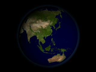
Landsat-7 20 Year Urbanization of Deep Bay near Shenzhen, China
|
The long operational history of the Landsat satellite allows a detailed study of urban growth around the world, as illustrated by this animation of urbanization around Shenzen, China.
|
|
|
|
The long operational history of the Landsat satellite allows a detailed study of urban growth around the world, as illustrated by this animation of urbanization in the Deep Bay region around Shenzen, China.
Duration: 31.0 seconds
Available formats:
720x486 (29.97 fps)
Frames
640x480 (30 fps)
MPEG-1
17 MB
160x80
PNG
10 KB
80x40
PNG
3 KB
320x240
JPEG
5 KB
How to play our movies
|
| Animation Number: | 2761 |
| Animators: | Lori Perkins (SVS) (Lead) |
| | Marte Newcombe (SVS) |
| Completed: | 2003-05-29 |
| Scientists: | Darrel Williams (NASA/GSFC) |
| | Karen Seto (Stanford University) |
| Instruments: | Landsat-1/MSS
|
| | Landsat-2/MSS |
| | Landsat-3/MSS |
| | Landsat-4/TM |
| | Landsat-5/TM |
| | Landsat-7/ETM+ |
| Data set: | Blue Marble 8K Context Texture |
| Data Collected: | 1973,1975,1977,1978, 1979, 1980, 1988, 1989, 1992, 1993, 1995, 1996, 1999, 2000, 2001 |
| Series: | Landsat 7 |
Keywords:
DLESE
>> Human geography
SVS
>> Reclamation
SVS
>> Shenzhen
SVS
>> Sprawl
SVS
>> Urbanization
GCMD
>> Location
>> China
GCMD
>> Location
>> Hong Kong
|
This work has been visible on
'10,000 Shovels: Rapid Urban Growth in China' a documentary filmalso part of a 87 page teaching module through the Standford Program on International and Cross-Cultural Education available at (http://spice.standford.edu/catalog/list ) |
| Science paper: | http://taylorandfrancis.metapress.com/link.asp?id=ruk29vgger44xvve |
|
Please give credit for this item to
NASA/Goddard Space Flight Center
Scientific Visualization Studio |
|
Back to Top
|
|
|
|

