


Weather Map - Click to Enlarge
Weather Outlook for Saturday
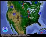
Sat, 17 Jan 2009 07:56:35 ESTAfter the record breaking bitter cold over much of the eastern half of the nation, especially from the Midwest into the Northeast, a warming trend will take place over much of these same areas over the next couple of days. Lake effect snow east of Lakes Erie and Ontario will dissipate early this morning however snow will return with a clipper system approaching from the Upper Mississippi Valley. Light snow is falling over parts of the western Great Lakes And will spread eastward today, reaching New England by Sunday morning. Several inches of snow are expected from the Great Lakes region into the Northeast. Over the Pacific Northwest, ridging will dominate during the short range period. Temperatures will continue to be above average, except in valley locations where fog and stagnant air are expected to be present. Latest local weather forecasts, warnings, watches, and advisories...