Click on a column heading to sort the list.
Click on an image for detailed information.
My
List |
Addition Date
|
Target
|
Mission
|
Instrument
|
Size
|

|
2006-01-25 |
Earth
|
Shuttle Radar Topography Mission (SRTM)
|
C-Band Imaging Radar
X-Band Radar
|
1586x1965x3 |
|
-
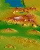
PIA06669:
-
Crater Highlands, Tanzania
Full Resolution:
TIFF
(9.365 MB)
JPEG
(540.6 kB)
|
|
|
2005-12-09 |
Earth
|
Shuttle Radar Topography Mission (SRTM)
|
C-Band Radar
X-Band Radar
|
1234x899x3 |
|
-
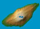
PIA06675:
-
Ambae Island, Vanuatu (South Pacific)
Full Resolution:
TIFF
(3.332 MB)
JPEG
(125.8 kB)
|
|
|
2005-09-22 |
Earth
|
Shuttle Radar Topography Mission (SRTM)
|
C-Band Imaging Radar
X-Band Imaging Radar
|
3621x1525x3 |
|
-
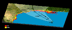
PIA06674:
-
Hurricane Rita Track
Radar Image with Topographic Overlay

Full Resolution:
TIFF
(16.57 MB)
JPEG
(452.1 kB)
|
|
|
2005-08-29 |
Earth
|
Shuttle Radar Topography Mission (SRTM)
|
C-Band Imaging Radar
X-Band Radar
|
1800x2061x3 |
|
-
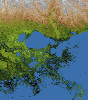
PIA04175:
-
Mississippi Delta, Radar Image with Colored Height
Full Resolution:
TIFF
(11.15 MB)
JPEG
(781.5 kB)
|
|
|
2005-08-29 |
Earth
|
Shuttle Radar Topography Mission (SRTM)
|
C-Band Imaging Radar
X-Band Radar
|
3000x2519x3 |

|
-
PIA04174:
-
New Orleans Topography, Radar Image with Colored Height
Full Resolution:
TIFF
(22.67 MB)
JPEG
(1.437 MB)
|
|
|
2005-03-16 |
Earth
|
Shuttle Radar Topography Mission (SRTM)
|
C-Band Imaging Radar
X-Band Radar
|
6587x8336x3 |

|
-
PIA06672:
-
Ireland, Shaded Relief and Colored Height
Full Resolution:
TIFF
(96.97 MB)
JPEG
(6.802 MB)
|
|
|
2005-01-14 |
Earth
|
Earth Observing System (EOS)
Shuttle Radar Topography Mission (SRTM)
|
ASTER
SIR-C/X-SAR
|
1987x1840x3 |

|
-
PIA06671:
-
Tsunami Inundation, North of Phuket, Thailand
ASTER Images and SRTM Elevation Model
Full Resolution:
TIFF
(10.98 MB)
JPEG
(737.4 kB)
|
|
|
2005-01-14 |
Earth
|
Shuttle Radar Topography Mission (SRTM)
|
C-Band Interferometric Radar
|
3000x5200x3 |

|
-
PIA06670:
-
Sri Lanka, Colored Height
Full Resolution:
TIFF
(28.95 MB)
JPEG
(3.425 MB)
|
|
|
2005-01-06 |
Earth
|
Shuttle Radar Topography Mission (SRTM)
|
Spaceborne Imaging Radar
C/X-Band Synthetic Aperture Radar
|
5342x1746x3 |
|
-
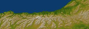
PIA06661:
-
Alpine Fault, New Zealand, SRTM Shaded Relief and Colored Height
Full Resolution:
TIFF
(22.84 MB)
JPEG
(1.473 MB)
|
|
|
2005-01-06 |
Earth
|
Shuttle Radar Topography Mission (SRTM)
|
Spaceborne Imaging Radar
C/X-Band Synthetic Aperture Radar
|
2919x1565x3 |

|
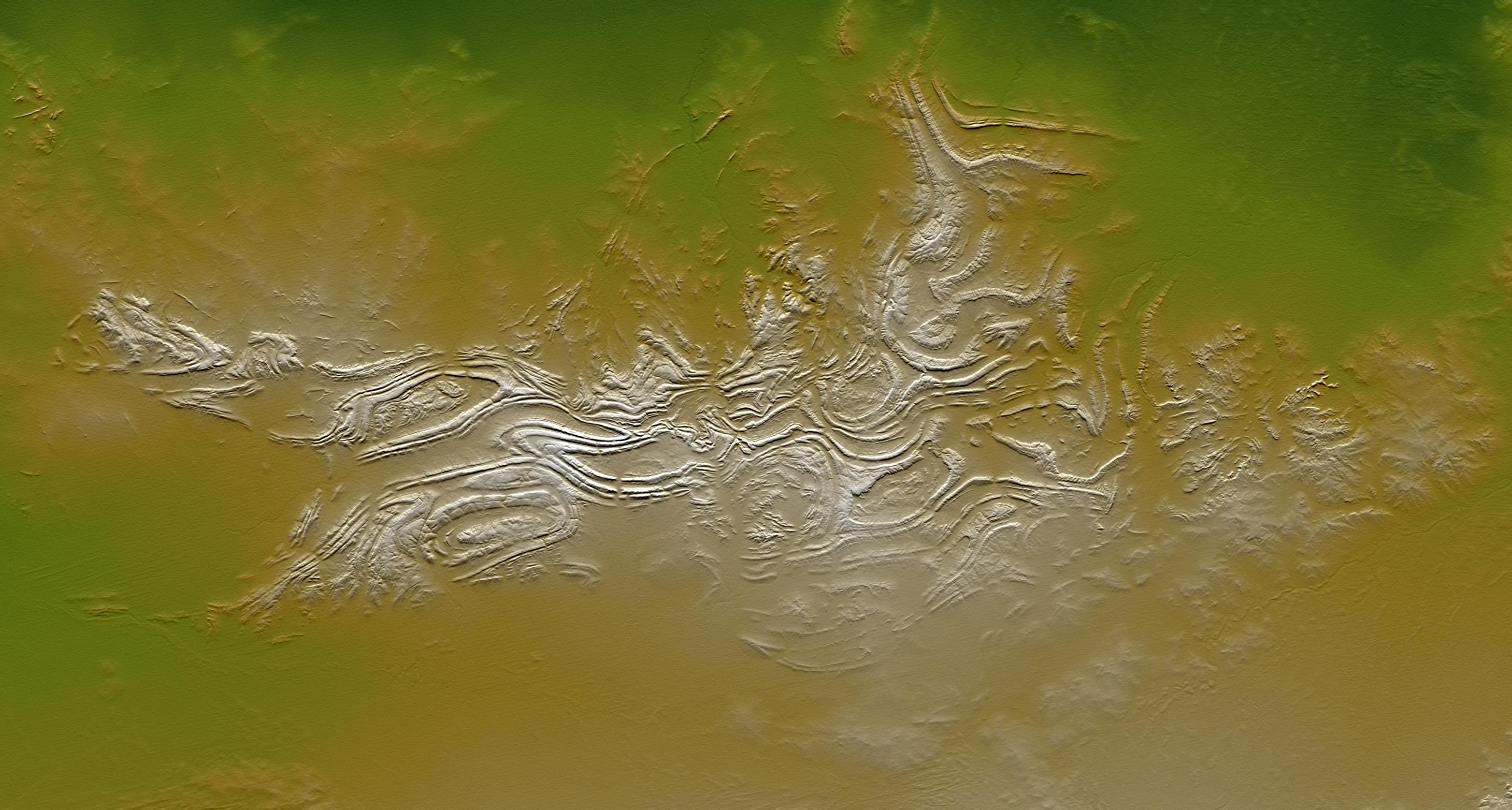
-
PIA06663:
-
Davenport Ranges, Northern Territory, Australia, SRTM Shaded Relief and
Colored Height
Full Resolution:
TIFF
(10.79 MB)
JPEG
(608.1 kB)
|


