|
Studying the planet as a whole gives us clues about Martian
geology and climate, and reveals the similarities and differences
between Mars and planet Earth.
|
 |
|
|

|
2005 Where is Mars in the Night Sky? Within two or three hours after sunset, look roughly in the eastern sky to find Mars. Mars will have a more reddish glow than the stars.
|
|
Read More
|
|

|
A Mid-Northern Summer/Southern Winter's Mars 04 Apr 2003
|
|
6 Browse Images (30 kB total) |
Full Size JPGs (~1.5 MB total)
|
|

|
The Martian Limb 04 Apr 2003
|
|
Browse Image (8 kB) |
Full Size JPG (131 kB)
|
|

|
Mars in Early Northern Spring 04 Apr 2003
|
|
Browse Image (13 kB) |
Full Size JPG (204 kB)
|
|

|
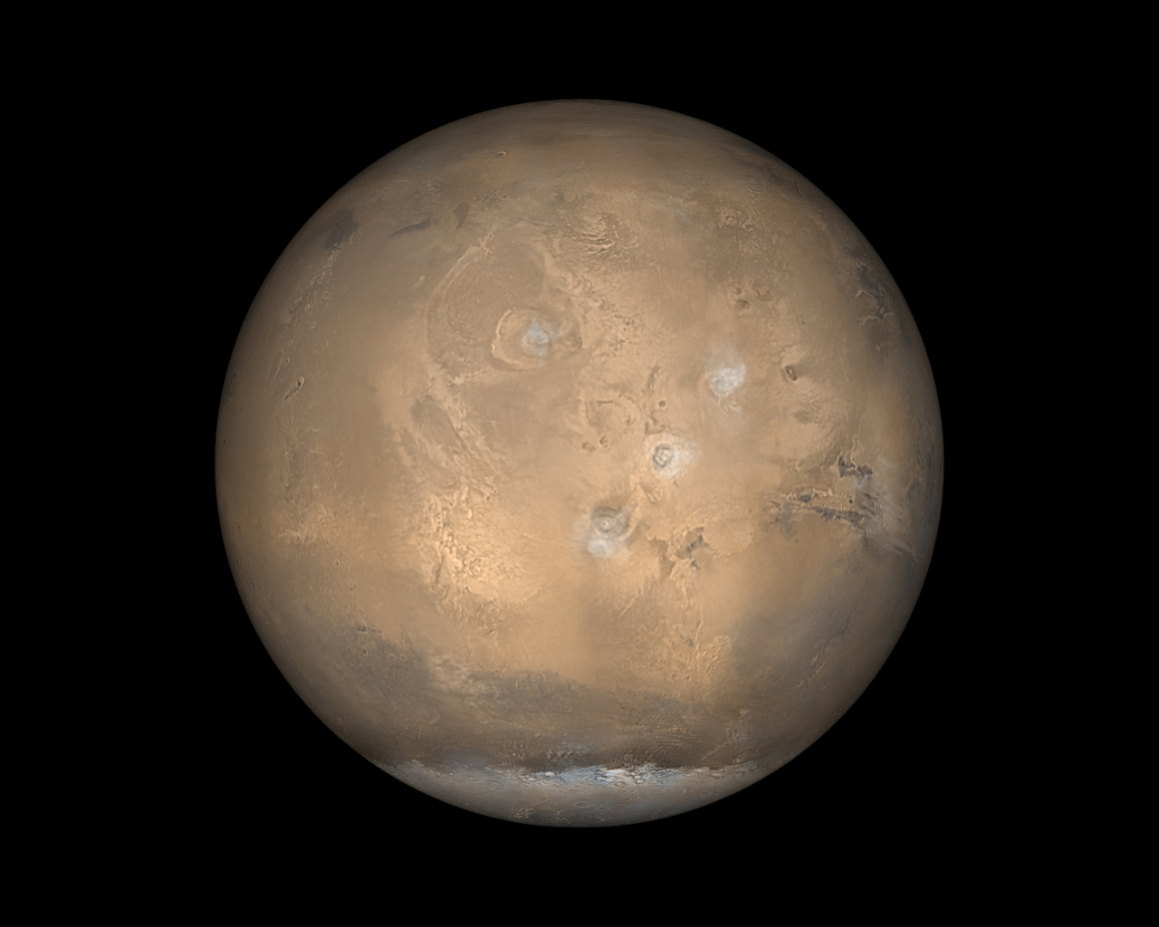
Global Image of Mars: Late in June 2001, as southern winter transitioned to spring, dust storm activity began to pick up as cold air from the south polar cap moved northward toward the warmer air at the martian equator.
|
|
Browse Image (6 kB) |
High Res JPG (2.9 MB)
|
|

|
Global Image of Mars: Late in June 2001, as southern winter transitioned to spring, dust storm activity began to pick up as cold air from the south polar cap moved northward toward the warmer air at the martian equator.
|
|
Browse Image (6 kB) |
High Res JPG (2.9 MB)
|
|

|
Global Image of Mars: Over the course of a single day, the wide angle cameras of the Mars Orbiter Camera (MOC) system take 24 pictures--12 red and 12 blue--that are assembled to create a daily global map. Such global views are used to monitor the martian weather and observe changes in the patterns of frost and dust distribution on the surface.
|
|
Browse Image (6 kB) |
High Res JPG (360 kB)
|
|

|
Global Image of Mars: Over the course of a single day, the wide angle cameras of the Mars Orbiter Camera (MOC) system take 24 pictures--12 red and 12 blue--that are assembled to create a daily global map. Such global views are used to monitor the martian weather and observe changes in the patterns of frost and dust distribution on the surface.
|
|
Browse Image (6 kB) |
High Res JPG (360 kB)
|
|
|

|
Thermal Image of Mars: This thermal infrared
image was acquired by Mars Odyssey's thermal emission imaging
system on October 30, 2001, as the spacecraft orbited Mars on its
ninth revolution around the planet. The image was taken as part
of the calibration and testing process of the camera system.
|
|
Browse Image (59 kB) |
High Res TIFF (978 kB)
|
|

|
Global Image of Mars: Mars Opposition and Equinox
|
|
Browse Image (23 kB) |
High Res TIFF (1 MB)
|
|

|
Global Image of Mars: Mars Global Surveyor data
creates a view of weather on Mars, with blue-white ice clouds
apparent.
|
|
Browse Image (469 kB) |
High Res TIFF (8 MB)
|
|

|
Hubble's Sharpest View of Mars: This image
was taken by Hubble just before Mars opposition, when the red
planet made one of its closest passes to the Earth.
|
|
Browse Image (496 kB) |
High Res TIFF (179 kB)
|
|

|
Syrtis Major and Arabia Terra: Mars Global
Surveyor provides a planetary view of Mars. The large bright
region is Arabia Terra, while Syrtis Major is the dark region toward
the lower right.
|
|
Browse Image (8 kB) |
High Res TIFF (887 kB)
|
|

|
Mars Albedo: When the sun shines on Mars, the
surface of the planet reflects that electro-magnetic energy
differently. Data from Mars Global Surveyor shows the
electro-magnetic reflectance (albedo) of the surface of Mars.
Red areas are brighter surfaces.
|
|
Browse Image (325 kB) |
High Res TIFF (19 MB)
|
|

|
Mars Gravity Map: Mars Global Surveyor data
creates a gravity map of Mars.
|
|
Browse Image (325 kB) |
High Res TIFF (15 MB)
|
|

|
Mars Thermal Inertia: Acquired during the first
5,000 orbits of the Mars Global Surveyor mapping mission, this
data shows the pattern of thermal inertia variations of Mars.
|
|
Browse Image (325 kB) |
High Res TIFF (20 MB)
|
|

|
Mars Crustal Magnetic Field Remnants: Mars Global
Surveyor shows strong Martian magnetic fields in the southern
highlands, where magnetic stripes possibly resulting from crustal
movement are most prominent. The magnetic fields appear to be
organized in bands, with adjacent bands pointing in opposite
directions, much like patterns seen in the Earth's crust at the
mid-oceanic ridges.
|
|
Browse Image (325 kB) |
High Res TIFF (11 MB)
|
|

|
Mars Topography: These images from Mars show
the high and low points on Mars. In the right hand image, the Hellas
impact basin marks a low point (in purple), while the left hand
view shows the large volcanoes in the Tharsis region (in red and white).
|
|
Browse Image (325 kB) |
High Res TIFF (20 MB)
|
|

|
Mars from Hubble: Frosty white
water ice clouds and swirling orange dust storms above a vivid rusty
landscape reveal Mars as a dynamic planet in this sharpest view ever
obtained by an Earth-based telescope. The Earth-orbiting Hubble telescope
snapped this picture on June 26, when Mars was approximately 43 million
miles (68 million km) from Earth -- its closest approach to our planet since
1988. Hubble can see details as small as 10 miles (16 km) across.
|
|
Browse Image (10 kB) |
TIFF (274 kB)
|


