|
|
 |
| Overview |
 |
|
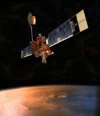 |
Artist's concept of Mars Global Surveyor
Image credit: NASA/JPL
|
|
|
Mars Global Surveyor was the first
successful U.S. mission launched to Mars since the Viking mission in 1976. After a 20-year
absence at the planet, Mars Global Surveyor ushered in a new era of Mars exploration with its
five science investigations. Mars Global Surveyor arrived at Mars on September 11, 1997
(September 12, UTC), and has contributed a multitude of findings, including signs of past, persistent water such as an
ancient delta and currently active water features in the gullies of canyon walls. After nearly a decade of discovery,
MGS went silent in November, 2006.
Innovative Engineering Enabled Longest Mission at Mars
The spacecraft's longevity is a testament to innovative engineering, and it has enabled
scientists to develop an unprecedented understanding of how the martian landscape and seasons
have been changing over time. When Mars Global Surveyor launched on November 7, 1996, it
carried with it a limited amount of propellant, and the spacecraft was expected to run out
of fuel in April of 2003, ending the capability to steer the ship with small engine thrusters
and point the science instruments accurately.
In August of 2001, the Mars Global Surveyor team implemented a clever "angular momentum management"
strategy that minimized the need for thrusters to help stabilize and balance the spacecraft and
keep it on target over viewing areas on the surface of Mars. Part of the angular momentum management scheme tips the spacecraft
at an angle 16 degrees backwards (instead of pointing straight down at the surface), which
effectively cuts the use of fuel by 800% on a daily basis.
Mars Global Surveyor Gives New Global View of Mars
 |
This animated image shows Mars in motion over the last six years. Images from the Mars Orbiter
Camera aboard the Mars Global Surveyor spacecraft have documented dramatic changes in the
planet's south polar cap.
Image credit: NASA/JPL/MSSS
|
|
|
|
Mars Global Surveyor was designed to circle in a polar orbit (traveling over the north pole to the south pole and
back to the north pole) once every two hours, twelve times a day, collecting global "snapshots" from
400 kilometers (249 miles) above the martian surface. While the spacecraft is no longer operating,
scientific data returned by the spacecraft will continue to be studied for decades to come.
During the mission, scientists gleaned valuable new information on daily and seasonal weather
patterns, geological features and the migration of water vapor from hemisphere to hemisphere
over time. The spacecraft's laser altimeter gave scientists their first 3-D views of the
striking topography of Mars. Mars Global Surveyor's suite of science instruments included
a high-resolution camera and a mineral detector that have helped engineers and scientists
select safe landing sites rich in various minerals like hematite, a mineral often formed in liquid water, in the quest to understand the history of water on Mars.
Mars Global Surveyor Follows the Water
In a landmark discovery, imaging scientists have seen gullies and debris flow features that
suggest there could be current sources of liquid water at or near the surface of Mars. While all current Mars missions aim to understand the role
of water on Mars to unlock the mystery of whether life could have developed on Mars in the past
or may survive in the subsurface now or in the future, Mars Global Surveyor also has been able
to characterize the topography, gravity, magnetic fields, thermal properties, surface composition,
and atmosphere of Mars.
Mars Global Surveyor fulfilled all of its science objectives.
|


