Activities Around the Lake
 Lake Berryessa receives approximately 1.5 million visitors every year, who participate in year around recreational activities. Lake Berryessa offers both Day Use Opportunities, and Resorts/Overnight Accommodations, as well as a variety of water-based activities and rentals.
Popular activities around Lake Berryessa include waterskiing, jet skiing, pleasure boating, kayaking and canoeing, hiking, road bicycling, motorcycle pleasure biking, birding, wildlife observation, picnicking, swimming, and similar activities.
Lake Berryessa is located approximately 45 minutes from the towns of Napa and Winters, and has limited facilities for some services. Before you visit Lake Berryessa, you can plan your trip to be sure you have all the equipment, licenses, and other gear you’ll need for a fun and safe trip. Please see Things to Remember for more details.
 Calendar of Events
For additional information on any of the events, please call a Berryessa Park Ranger at 707/966-2111 ext 112
For more information on how to schedule a program, please contact Park Ranger Mike McGraw at 707-966-2111 ext 112
Once you have obtained a permit to hold a public special event around Lake Berryessa (fishing tournament, triathlon, Earth Day event, etc.) we can post that information on our website Calendar of Events.
Past Events
National Public Lands Day Event At Lake Berryessa
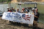
 On September 30th, Lake Berryessa participated in the 13th National Public Lands Day under the auspices of the Take Pride in America (TPIA) program. The event is the nation’s largest hands-on volunteer effort to improve and enhance America’s public lands. This year, eight volunteers and three members of the Berryessa park staff spent several hours removing trash and large debris piles from Pope Creek Canyon. Participant cleared garbage on foot, with a boat, and by using several kayaks. Berryessa Trails and Conservation, a non-profit organization based in Napa County, was instrumental in organizing the event. In addition to trash removal, participants also performed maintenance on the Pope Canyon Trail. Overall, the day was a fine way to “get down and dirty” for Berryessa.
Lake Berryessa Cleanup Day 2006 – A Success
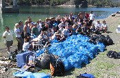
 On September 16th, 135 volunteers (including 97 divers) spent the morning cleaning the Pope Creek Bridge Area of Lake Berryessa. The event was part of Coastal Cleanup Day, a statewide and international effort to clean trash and debris from coasts, bays, creeks, rivers, and lakes. For seven years know, Napa Dive and Sports, along with Reclamation and many concerned people in the community, have been pulling debris out of the water and gathering garbage from around the lakeshore. This year’s effort netted 1,080lbs (40 bags) of “recycables” and 450lbs (12 bags) of trash. Beneath the surface of the lake, divers found a treasure trove of items; including a couple dozen sunglasses, a walkman stereo system, numerous pairs of shoes, and beer cans with resident crayfish inside. Along the shoreline children and adults picked-up Styrofoam, cans, bottles, glass and plastic containers. Cleanup Day ended with a well deserved BBQ feast. Big thanks to the Napa County Department of Environmental Management, Napa County Resource Conservation District and especially Napa Dive and Sports for helping to make this event possible.
Road Bicycling
Highway 128 and Pope Canyon Road provide very scenic and challenging road conditions for bicycle enthusiasts. Several century rides and competitive bicycling events are held every year around Lake Berryessa. Look for more information on our Calendar of Events. Safety – When planning a bicycle trip or event at Lake Berryessa, remember that there are few shoulder areas along Highway 128 and Knoxville Roads, many blind turns, and few passing lanes for cars. Unfortunately, there are several bicycle/vehicle accidents each year on our roadways. Please be aware on the road, ride single file, and pull over to let cars and trailers pass you in tight areas.
Oak Shores and Smittle Creek Day Use Parks
Reclamation manages and maintains a contiguous 3 mile stretch of shoreline for public day use activities, encompassing Oak Shores Day Use Park, Smittle Creek Trail, and Smittle Creek Day Use Park. Recreational opportunities include picnicking, swimming, non-motorized boating, hiking, wildlife viewing, fishing, and boat mooring for day use (bring your own anchor or stake), among others. Both Day Use Parks offer beautiful views of Lake Berryessa and a wonderful place to enjoy the lake. Summer weekends are busy, so come early to find good parking. Oak Shores and Smittle Creek are patrolled year round by Park Rangers who are available for visitor information and safety.
Entrance is FREE for both Day Use Parks and all dispersed areas around Lake Berryessa.
Park Hours of Operation: 7:00 a.m. – dusk, year around
(Closing time varies seasonally; see entrance sign for designated closing time)
Facilities available in Oak Shores include picnic tables, charcoal grills, two hand boat launches, ADA accessible restrooms, two designated swim beaches with no boat access, and shade shelters available on a reservation basis (see below). The Entrance Station and Water Education and Information Station are open on summer weekends to find information on recreational opportunities, water safety, conservation, or talk with a Ranger.
Facilities available in Smittle Creek are slightly more challenging to access and are spread out among rolling hills and along Smittle Creek Trail. They include picnic tables, charcoal grills, trails, and ADA accessible restrooms (trails may not be fully accessible to reach the restrooms).
You may bring your own propane or gas grill, but must use park grills for charcoal fires. No wood fires are permitted on Reclamation lands. Please bring cans or plastic and leave glass containers at home. No trailers are permitted inside Oak Shores or Smittle Creek Day Use Parks, so plan accordingly.
Please see our Park Rules for more information and to assist
you in planning a great family outing!
Capell Cove Boat Launch Day Use Area
Reclamation offers a free motorized boat launch and trailer parking on the northwest shore of Lake Berryessa. Trailer parking is available on a first come, first served basis, so plan to arrive early on summer weekends. ADA accessible restrooms and an ADA accessible boat dock on the launch ramp are available. Capell Cove is also a popular shoreline and boat fishing location.
- Resort and Facilities Map (pdf - 1.4 MB)
- Oak Shores Brochure (pdf - 1.7 MB)
Other Activities Around the Lake
- Oak Shores and Smittle Creek Day Use Area
- Capell Cove Boat Launch Day Use Area
- Fishing
- Hiking
- Hunting
- Kayaking/Canoeing
Lake Berryessa is part of a larger watershed that includes several regional recreational opportunities.
Quail Ridge
Formed in 1984 by the Quail Ridge Conservatory and now part of the University of California's Natural Reserve System, Quail Ridge provides excellent research and educational opportunities for students and the public. This unique area, located on a peninsula jutting into Lake Berryessa, supports one of the best examples of minimally impacted native California oak woodland, chaparral, and grassland in the state. Shaded trails wind through native California bunch-grasses - grasses that once flourished on 25 million acres in California but are rarely seen today. Tours of the area are available through the University of California, at Davis.
The Donald and Sylvia McLaughlin Reserve
Located within the North Coast Range of California, the Donald and Sylvia McLaughlin Reserve represents largely serpentine mixed chaparral habitat. The current reserve is comprised of lands on long term lease from Homestake Mines and Bureau of Land Management properties, and is held as an Area of Critical Environmental Concern. Adjacent to the reserve, Homestake Mine owns several thousand acres upon which they have an active mining operation. The current reserve is considered to be the first of a three phase conversion of properties owned by Homestake Mine. Eventually the reserve will contain all of the lands owned by Homestake Mines as they wind down operations over the next 20-30 years. Excellent opportunities for research in restoration/reclamation, geology and serpentine habitats are available.
The Stebbins Cold Canyon Reserve
The Stebbins Cold Canyon Reserve consists of 576 acres in the drainages of Wild Horse and Cold Canyons. It is accessible by the Stebbins/Cold Canyon Trailhead just below Monticello Dam near Canyon Creek Resort. Most of the land bordering the reserve is public. Thus, approximately 4000 acres of wildlands are available for study. The reserve's topography is primarily steeply sloping, with almost no flat land. This topography creates frequent slips and landslides, resulting in excellent opportunities for succession research. Thus far, the list of vascular plants of the Cold Creek basin includes 322 species. The fauna includes most of the familiar species of the inner Coast Range area. Overall, the diversity of plants and animals is remarkable given the reserve's small size. The reserve's trails are open to the public, year-round. All access off of the trails should be limited to permitted researchers and classes.
Lake Berryessa State Wildlife Area
The Lake Berryessa Wildlife Area is cooperatively managed by Reclamation and the California Department of Fish and Game. The federal land on the eastside of Lake Berryessa, above the high-water mark (elevation 440 feet msl), totals 2,000 acres. Of this, most of the northern 1/3 is annual grassland with scattered valley oaks and riparian corridors, while blue oak woodland communities dominate the middle and southern portions. Eastside Road, a gravel road maintained by Reclamation, serves the northern portion of the wildlife area and allows access to pedestrian only trails, wildlife viewing, and fishing along the shoreline. The east side of this road, or land side, is not accessible to the public. The road provides access to east side ranches, residences, and the upper 1/3 of the wildlife area. It’s also used by Reclamation, California Department of Fish and Game, and the California Department of Forestry and Fire Protection.
Access to the southern portion of the wildlife area is by boat only, from boat ramps on the west and south sides of the lake. Unlike the northern 1/3 of the wildlife area, where extensive shallows occur, the southern portion is composed of hills and canyons that drop precipitously into the lake. There, the blue oak woodlands are relatively dense, with small, scattered openings throughout.
Cedar Roughs, Area of Critical Environmental Concern
The ridges and hillsides just two miles west of Lake Berryessa are set aside by the Bureau of Land Management (BLM) as the Cedar Roughs Research Natural Area. The area is lush with natural flora and fauna, mainly the Sargent Cypress, whiteleaf manzinita, leather oak, and digger pine. Cedar Roughs supports a variety of common terrestrial wildlife species. One special aspect of the area is that it is the only known area in Napa County where black bears breed.
Cedar Roughs includes over 6,500 acres of public lands administered by the BLM and are accessible through lands administered by the California Department of Fish and Game (CDFG) and the Bureau of Reclamation. The area is accessible from Pope Canyon Road in Napa County. These lands are available for non-mechanized recreational activities such as wildlife viewing, hunting, fishing, hiking, and camping. Cedar Roughs is designated a Wilderness Study Area (WSA) and an Area of Critical Environmental Concern (ACEC) to protect unique botanical values (including the world's largest known stand of "genetically-pure" Sargent Cypress). The Cedar Roughs Area is adjoined to the 30,000 acre Lake Berryessa Recreation Area (LBRA) administered by Reclamation.
Access
Please stay on public lands unless you have written permission from adjacent private landowners to use or cross their private land. Legal access is only possible from the north along Pope Canyon Rd. The three major access points in the Cedar Roughs area are:
- Cedar Roughs Access by Land- Located off Pope canyon Rd., 2.3 miles west of Pope Creek bridge, Lake Berryessa or 6.2 miles east of the Pope Valley air strip. Provides access to approximately 238 acres of CDF&G and 6,350 acres of BLM land. Park on south side of white gate, cross through the gate opening, follow trail markers northward, cross Pope Creek and climb hill a short distance to an abandoned Jeep trail. Jeep trail provides access into main block of public land. Note: Where Abandoned jeep trail crosses Pope Creek is on private land!
- Lake Berryessa Access - Pope Creek Arm - Located 2.2 miles west of Pope Creek bridge, or 6.3 miles east of the Pope Valley air strip. Provides access to the Pope Creek arm of Lake Berryessa which provides several fishing access points. By packing a small rubber raft (and PFDs), you'll be able to cross the Pope Creek Arm of the lake to the boat access trail head to Cedar Roughs. From the brown and yellow gate, hike 0.6 miles southward to a "Y" in the trail. From the "Y," go right 0.3 miles down the hill to the water crossing, then raft across.
- Cedar Roughs Access by Boat - Located 1.8 miles past Pope Creek Bridge on the Pope Creek Arm of Lake Berryessa. Nine boat ramps are accessible from the south and west sides of the lake.
Hiking Tips
- Be prepared for a rugged hike. There are few signed and no maintained trails in Cedar Roughs.
- Wear long pants and sturdy shoes. Much of the area is very brushy.
- Be aware of ticks and watch out for rattlesnakes.
- Beware of the sun in the summer. Bring sun block, a hat, and plenty of water.
- During the summer, begin hiking early to avoid uphill climbs during the heat of the day.
- The prime hiking seasons are in Spring and Autumn.
Need to Know
- Stay on public lands. Do not trespass onto private property.
- Fire permits, available from any BLM, CDF, or U.S. Forest Service Office, are required. Open fires are prohibited during declared fire season.
- Camping, open fires, hunting, and the use of firearms are prohibited on BOR administered land.
- BOR "Firearm Permits" are required when carrying firearms on Reclamation lands and water. Permits are available to hunters only at the Park Headquarters Office, weekdays 8 a.m. to 4 p.m. Bring your hunting and drivers licenses and the CF number of the boat (if any) to obtain a permit. For more information contact the BOR Park Headquarters at (707) 966-2111.
Leave No Trace
- Pack it in, pack it out (including spent shell casings).
- Leave what you find.
- Be careful with fire.
For More Information
- Bureau of Land Management
Clear Lake Resource Area
707/468-4000 - California Department of Fish and Game
Region 3
707/944-5000 - Bureau of Reclamation
Lake Berryessa
707/966-2111

