Worldbook at NASA

Image of thunderstorm supercell

NASA Worldbook article discusses weather: what causes it, how to measure and forecast it, and how people affect it.

› View Site

SERVIR Latest News

    NASA and USAID Bring Earth-Observation Benefits to Africa

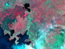
    SERVIR Africa team multispectral image of the Nzoia River basin in Kenya

    SERVIR-Africa multispectral imagery of the Nzoia River basin in Kenya. Image Credit: NASA/EO-1

    NASA, the U.S. Agency for International Development (USAID) and their international partners cut the ribbon Friday in Nairobi, Kenya, for SERVIR-Africa. The SERVIR-Africa system integrates the satellite resources of the United States and other countries into a Web-based Earth information system. This effort puts previously inaccessible information into the hands of local scientists, government leaders and communities to help address concerns related to natural disasters, disease outbreaks, biodiversity and climate change.

    > News Release
    > Photo

More About SERVIR

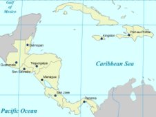
    The SERVIR initiative integrates satellite observations, ground-based data and forecast models to monitor and forecast environmental changes and to improve response to natural disasters. SERVIR enables scientists, educators, project managers and policy implementers to better respond to a range of issues including disaster management, agricultural development, biodiversity conservation and climate change. Endorsed by governments of Central America and Africa and principally supported by NASA and the US Agency of International Development (USAID), a strong emphasis is placed on partnerships to fortify the availability of searchable and viewable earth observations, measurements, animations, and analysis. A SERVIR coordination office and rapid prototyping facility is located at the NASA Marshall Space Flight Center in Huntsville, Alabama. Regional SERVIR nodes are located at the Water Center for the Humid Tropics of Latin America and the Caribbean (CATHALAC) in Panama and the Regional Center for Mapping of Resources for Development (RCMRD) based in Kenya.

News and Features

  • Flooding in Gonaives, Haiti in September 2008

    Flooding in Gonaives, Haiti  →

    The flood-prone city of Gonaïves, Haiti experienced deadly flooding in both 2004 and 2008, when tropical storms inundated the northeastern corner of the country.

  • SERVIR weather data

    NextStorm Gives Early Warning for Hazardous Weather

    NASA announces a new web-based product for short-term predictions of thunderstorms, lightning, and heavy rains that can result in severe floods in Central America and southern Mexico.

Multimedia Gallery

SERVIR Lab in Action

Focus on Marshall graphic

View Focus on Marshall episode.

› View This Video

Features

    A SERVIR test bed node at the National Space Science and Technology Center in Huntsville, AL. Aiding Central America
    NASA researcher Dan Irwin helps pioneer SERVIR development -- and finds out he's running for mayor.
    > Science@NASA Feature
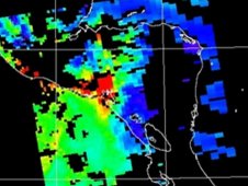
    Accumulated rainfall during Panama floods Floods! Fire! SERVIR
    SERVIR aids Panama's goverment in helping to predict landslides.
    > Science@NASA Feature

Other Resources

Media Contacts

    For media support regarding SERVIR, please contact:

    Jennifer Morcone
    Marshall Space Flight Center
    Phone: 256-544-0034