![]() |
| ![]()
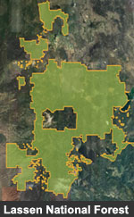
Maps and Brochures
![]() Forest Maps [Printable Maps too!]
Forest Maps [Printable Maps too!]
![]() Google Earth KMZ File (You may need right-click and save to computer in order to view.)
Google Earth KMZ File (You may need right-click and save to computer in order to view.)
Where to Purchase
 Forest
Visitor maps, Wilderness maps, and Topographic Quadrangle
maps may be purchased at any unit
office on the Lassen National Forest or online at the National
Forest Store.
Forest
Visitor maps, Wilderness maps, and Topographic Quadrangle
maps may be purchased at any unit
office on the Lassen National Forest or online at the National
Forest Store.
You can also request a map by postal mail from our Headquarters' Office in Susanville.
Enclose a check for $9.00 for the large forest map. Make payable to "US Forest Service", and on the envelope please note, "map request". Be sure to include the address for returning your map.
Forest Visitor maps and Wilderness maps of the Lassen National Forest and other National Forests in California can also be ordered by phone 7 days/week from the National Forest Store at (406) 329-3024. Visa, Master Card, American Express, Discover are accepted. There is no postage or handling charge.
Forest Maps
Order Maps - Maps and Brochures of the Lassen are available by ordering directly from Lassen National Forest.
- Forest
Visitor Map (Lassen, Plumas, and Modoc)
Depicts National Forest System Lands, and other agency and privately owned lands along with lakes, roads, trails and recreation sites and facilities. Scale 1/2"/mile. $9.00 - Wilderness
Map
This Map is a 1"/mile contour map of the three Lassen Wilderness areas, Thousand Lakes, Caribou and Ishi. The map includes lakes, trailheads, trails, campgrounds, adjacent roads, and facilities. $9.00 - 7.5' Quandrangle Topographic Maps
This 89 page book divides the forest up into 7-1/2 minute standard page size quandrangle maps for Lassen National Forest. Great map book for touring the forest!
Print Quad Maps - Find the Quad you want to map, click on it, and print.
Regional Forest Maps and Brochures - Forest Visitor maps of the Lassen National Forest and other National Forests in California can also be ordered by phone 7 days/week from the National Forest Store at (406) 329-3024. Visa, Master Card, American Express, Discover are accepted. There is no postage or handling charge.
National Atlas
Find tons of great maps for the entire United States here. From Federal Land to Presidental Election Maps, this is the place.
Fire Mapping
Check out the local fires going on around the US with this great tool.
Forest Aviation Hazards Map - If you are flying over the Lassen National Forest boundaries, this map will help in your navigation.
Recreation Sites Map
Guide and Brochure Downloads
![[image] Lassen National Forest Visitor Guide](https://webarchive.library.unt.edu/eot2008/20090118074622im_/http://www.fs.fed.us/r5/lassen/imgs/maps_lassen_vistor_guide.gif) Lassen
National Forest Visitor Guide
Lassen
National Forest Visitor Guide
(pdf document - 1.1 mb) This
visitor guide includes information on local
community events, road trips, campgrounds,
an area map, wood permit info., hiking trails,
safety tips and more!
![]() Hat Creek Recreation Map
Hat Creek Recreation Map
(pdf document, 5 mb)
Map showing the Hat Creek area.
![[image] Trees of the Lassen](https://webarchive.library.unt.edu/eot2008/20090118074622im_/http://www.fs.fed.us/r5/lassen/imgs/maps_trees_brochure.gif) Trees
of the Lassen
Trees
of the Lassen
(pdf document, 672 kb) Ten of the more common trees
found on the Lassen National Forest.
![[image] Pacific Crest Trail](https://webarchive.library.unt.edu/eot2008/20090118074622im_/http://www.fs.fed.us/r5/lassen/imgs/maps_pct_brochure.gif) Pacific
Crest Trail
Pacific
Crest Trail
(pdf document, 446 kb) The Hat Creek District
offers 58 miles of trail that winds through scenic vistas and geologic
wonders.
![[image] Hat Creek Adventures](https://webarchive.library.unt.edu/eot2008/20090118074622im_/http://www.fs.fed.us/r5/lassen/imgs/maps_hatcreek_brochure.gif) Hat
Creek Adventures
Hat
Creek Adventures
(pdf document, 522 kb) A list of Recreation Activities available
in the Hat Creek Recreation Area.
![[image] Subway Cave Adventure](https://webarchive.library.unt.edu/eot2008/20090118074622im_/http://www.fs.fed.us/r5/lassen/imgs/maps_subwaycave_brochure.gif) Subway
Cave
Subway
Cave
(pdf document, 553 kb) A Self Guided Trail guide and map.
![[image] Spattercone Trail](https://webarchive.library.unt.edu/eot2008/20090118074622im_/http://www.fs.fed.us/r5/lassen/imgs/maps_spattercone_brochure.gif) Spattercone
Trail
Spattercone
Trail
(pdf document, 645 kb) A Self Guided Trail guide. The 1.5
mile loop will take you to the origin of the recent Hat Creek Lava
Flow.
![[image] Mushroom Picking Tips](https://webarchive.library.unt.edu/eot2008/20090118074622im_/http://www.fs.fed.us/r5/lassen/imgs/maps_mushrooms_brochure.gif) Mushroom
Picking Tips
Mushroom
Picking Tips
(pdf document, 362 kb) Picking mushrooms is an enjoyable
activity that takes nor more than a simple basket, a knife, and
knowledge of the forest and its fungi. To make it enjoyable for
everyone, please consider these picking tips. Also don't forget
a Special Forest Product
Permit.
![[image] Winter Recreation](https://webarchive.library.unt.edu/eot2008/20090118074622im_/http://www.fs.fed.us/r5/lassen/imgs/fsicon_snow_flake.gif) Winter
Recreation on the Lassen National Forest (Not Available
Online click here to go to our web section)
Winter
Recreation on the Lassen National Forest (Not Available
Online click here to go to our web section)
The Forest has six winter OHV areas on three districts. Miles
of groomed versus non-groomed trails varies by area.
Forest GIS Data
![]() GIS
(Geographic Information Systems) Data Layers are available on the Pacific Southwest Regional website.
GIS
(Geographic Information Systems) Data Layers are available on the Pacific Southwest Regional website.
Here you will find geospatial data for the National Forests in California, along with regionwide, provincewide, and statewide datasets available for download.
U.S. Geological Survey (USGS) Maps
![]() National
Forest and Grassland Maps - One stop shopping for all Forest and
Grassland maps Nationwide, distributed by the U.S. Geological Survey (USGS).
National
Forest and Grassland Maps - One stop shopping for all Forest and
Grassland maps Nationwide, distributed by the U.S. Geological Survey (USGS).
USGS Maps (Topographic Quadrangle Maps) of National Forest areas are available on the USGS web site.
USGS - National Mapping Information
Specialty Maps
Eagle Lake - these maps can be purchased at the Eagle Lake Marina.
Phone
(530) 825-3454.
Other Specialty Maps - Contact our front desk.
Phone (530) 257 - 2151
- Site Map
- Doing Business with Us
- Payments to States
- Evaluate our Service
- Northern California Consortium
- Desktop Pictures
- Privacy Policy
- Accessibility

![]()
![]()
PDF Files Require Adobe Reader
![]()

Page Last Updated:
Wednesday, October 8, 2008 10:29