Get Out For A Quick Hike Near Redding
 Mountain bikers and horseback riders can challenge the Mule Mountain Trail; hikers can enjoy the Sacramento River Rail Trail, soon to connect downtown Redding and Shasta Dam; and explorers can enjoy the open space of the Clear Creek Greenway. More
Chappie-Shasta OHV Area
 The Chappie Shasta Off-Highway vehicle area offers 200 miles of roads and trails for off-road enthusiasts, and spectacular views of Shasta Dam, Shasta Lake, and Mount Shasta. Camping is available near the staging area below Shasta Dam. More
The Fishing is Great on the Trinity River
 The Wild and Scenic Trinity River, between Lewiston and Pigeon Point, is the home of world-famous fly fishing. Adrenaline junkies can ride the raging waters below Pigeon Point, while visitors interested in relaxation can enjoy the abundant camping or head for the trail. More
Sacramento River Bend Area
 Visitors can hike or horseback-ride the Yana trail, or lazily float down the Sacramento River in a raft or canoe. Hunters will find abundant deer, pigs and waterfowl in the Paynes Creek Wetlands. More
Forks of Butte Creek - There's Gold!
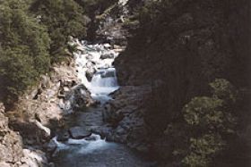
The beautiful Forks of Butte Creek area, 25 miles northeast of Chico, has trails through steep canyons covered in pine and fir trees, and offers dredging (via permit) and free low-impact gold-panning for your mining pleasure.
More