FEMA conducts a Flood Insurance Study (FIS) of a region to identify the community's risk levels. The FIS includes statistical data for river flow, storm tides, rainfall and topographic surveys, as well as hydrologic and hydraulic analyses. After examining the FIS data, FEMA creates a map delineating the different areas of flood risk.
Buildings in floodplains, or Special Flood Hazard Areas (SFHAs), are at high risk for flood damage. Some floodplains experience frequent flooding, while others are affected only when there is a severe storm.
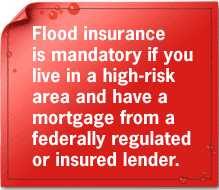
As a homeowner in a floodplain, it's not so much a question of if a flood will damage your property, as when. That's why the law requires you to have flood insurance. Did you know that an SFHA home has a 26% chance of being flooded over a 30-year period?
Each community that chooses to participate in the NFIP works closely with the Federal Emergency Management Agency (FEMA). Together, they collect the information needed to create an accurate Flood Insurance Rate Map (FIRM) and Flood Insurance Study (FIS) of the region. The FIRM and FIS will later be used to determine flood insurance rates for homeowners.


500 C Street SW, Washington, D.C. 20472
Disaster Assistance: (800) 621-FEMA, TTY (800) 462-7585
U.S. Department of Homeland Security
FEMA Home | Contact FEMA |
Privacy Policy | Important Notices |
FOIA | USA.gov | DHS
