Fire Weather
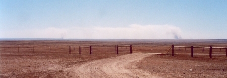
Wednesday, July 26th, 2006The two pictures show two forest fires burning to the southeast of where we were hiking on 16 July. We were north of the Charles M. Russell Wildlife Refuge, in northeastern Montana. The wind was strong — 32-48 kilometers per hour — and blowing from the west-northwest.
It is likely that lightning from thunderstorms on the evening of 14 July started both fires — and four more we saw on the 16th. 15 July was cool with light winds, and the ground was wet from the rain, so the fires grew slowly. But on 16 July, strong winds, hot temperatures, and low relative humidity made the fires grow much faster. We had been warned — there was a “Red Flag Warning” for high fire danger — because of an extended drought, hot temperatures, strong winds, and dry vegetation.

 Figure 1. Top: Forest fires to the southeast about noon on 16 July 2006, off Dry Fork Road, north of the Charles M. Russell Wildlife Refuge. Bottom: At same location about one hour later. Notice that the smoke reaches farther up off the ground.
As we watched, the plumes of smoke sometimes rose almost vertically, suggesting rapid upward movement. Were we looking at the fires from the side — so that the wind was traveling exactly from right to left — we could have estimated the upward wind speed from the tilt of the smoke plumes. For example, a 1:1 tilt (45 degrees) would mean the hot smoke was rising at the same speed as the wind was carrying it to the left — 32-48 kilometers per hour.
From looking at the position of the fire from different locations as we drove toward Malta, Montana, we guessed that the fire to the right was about 25 kilometers to the southeast of where the photographs were taken.
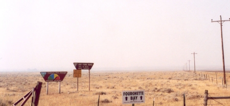
The next day, we wanted to come back to roughly the same spot, but the wind had changed to southeast, carrying the smoke directly toward us. We could barely see distant hills, and it was hard to breathe. The wind direction change was good for the firefighters, however, since the fire was being blown back over fuel (e.g., trees or grass plus fallen leaves, etc.) that had already burned.
 Figure 2. Signs of Dry Fork Road off U.S. 191, showing poor visibility on the 17th of July 2006.
See the January 2004 Chief Scientist’s message and the Fire Fuel Protocol if you want to find out more about wildfires.