Mouse Location* Water Depth: Off Latitude: N/A N Longitude: N/A W * All mouse location values are estimates only.
Click on the image to zoom in
Graphical representation of flood inundation for NWS flood categories are based on steady state hydraulic modeling of water surface elevations for incremented discharges. Map shows approximate inundation areas for given water surface elevations and should not be used for navigation or permitting or other legal purposes, but strictly as a planning reference tool.
Historical Crests
(1) 20.50 ft on 08/22/1940
(2) 17.80 ft on 03/15/1912
(3) 15.00 ft on 09/26/1945
(4) 13.10 ft on 02/22/1948
(5) 13.01 ft on 09/18/1999 Show More Historical Crests
Homes north and south of Williamston are flooded. Secondary roads adjacent to the river are under water and impassable. Evacuation of some residents in flood prone areas needed.
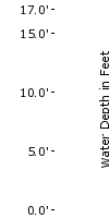
15.0
Many secondary roads near the river are flooded. Thousands of acres of farmland are flooded...some evacuations of farm animals needed. Residents who live in flood prone areas near the river should begin to move property to higher ground.
13.0
Many acres of farmland are flooded. Water will begin to reach some secondary roads near the river.
12.0
WIDESPREAD LOW LAND FLOODING CAN BE EXPECTED ADJACENT TO THE RIVER.
11.0
LOW LAND FLOODING ADJACENT TO THE RIVER CAN BE EXPECTED.
10.0
Minor lowland flooding adjacent to the river can be expected.
The National Weather Service prepares its forecasts and other services in collaboration with agencies like the US Geological Survey, US Bureau of Reclamation, US Army Corps of Engineers, Natural Resource Conservation Service, National Park Service, ALERT Users Group, Bureau of Indian Affairs, and many state and local emergency managers across the country. For details, please click here.
NWS Information
National Weather Service
Newport/Morehead City Weather Forecast Office
533 Roberts Rd
Newport, NC 28570
(252) 223-5122 Ask Questions/Webmaster
Page last modified: 12-Jun-2008 4:20 PM