Feature
Native Views from Space
11.20.03
| Who are NASA's Earth Explorers? The elementary school student questioning if El Niño occurs anywhere besides the Pacific Ocean. The researcher investigating connections between Arctic ozone depletion and global climate change. The consumer comparing hydrocarbon versus hydrogen-powered cars. And the business person projecting future needs for harvest, delivery and storage of crops. All of these people are Earth Explorers -- they are all connected by their curiosity about Earth system processes. This monthly series will introduce you to NASA Earth Explorers, young and old, with a variety of backgrounds and interests. |

|
James Rattling Leaf |
James Rattling Leaf, a member of South Dakota's Rosebud Sioux tribe, is helping Native Americans to see interactions between Earth's various components -- land, air, water and living things -- in a new light. As director of the Land and Natural Resources Program at Sinte Gleska University's (SGU) Sicangu Policy Institute, Rattling Leaf heads several projects under the NativeView initiative aimed at improving resource management, agriculture, economic development and education through the use of NASA data and technology.
NativeView is a geospatial education and application effort led by SGU, a tribal college located on the Rosebud Reservation in Mission, South Dakota, in cooperation with the United States Geological Survey (USGS). In all, more than 30 tribal colleges and universities around the country are involved in the project.

|
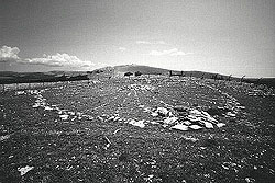
The Big Horn Medicine Wheel in Wyoming Dates Back to the 1800s |
Taking this idea even further, SGU and Spatial Data Technologies have developed a combination mapping and historical information tool called Rez Mapper, which not only provides traditional data and imagery showing landscape features, demographics and political boundaries, but also incorporates geographically relevant cultural information, including songs, stories, and historical documents and photographs.
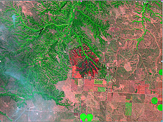
Much of the space-based information used as part of NativeView comes from NASA's Landsat 7 satellite. Last year, an image captured by the satellite helped support damage assessment in the aftermath of a fire on the Rosebud Reservation.
And that's just the beginning of many decision-making applications to come, according to Rattling Leaf. Funding from a recently awarded NASA Cooperative Agreement Notice will allow SGU and the USGS to unite various Native American-related projects involving the development of policy and resource management decision support systems and educational tools.
Training and inspiring current and future scientists, Native American or otherwise, is critical to achieving NativeView's -- and NASA's -- goals. "The utilization of NASA resources will ultimately provide a practical means for addressing contemporary issues and present balanced solutions to the challenge of traditional [Indian] philosophies to consider the welfare of [future generations]," Rattling Leaf said.
Next month's Earth Explorers: GLOBE students go international with trip to Croatia.

|
This Image from NASA's Landsat 7 Satellite Helped Support Damage Assessment After a Fire on the Lands of South Dakota's Sioux Tribe (USGS Image) |
Landsat 7 Education page
http://landsat.gsfc.nasa.gov/main/education.html
NativeView site
http://www.sinte.edu/nativeview
From A Distance: An Introduction to Remote Sensing/GIS/GPS
http://education.ssc.nasa.gov/ltp