Salmon-Challis National Forest
| www.reserveusa.com -- online campsite reservations | |
| www.publiclands.org -- (information on recreation sites on public lands in the west) | |
| National Interagency Fire Center -- NIFC | |
| Evaluate
Our Service We welcome your comments on our service and your suggestions for improvement. |
Salmon-Challis National Forest (208) 756-5100 |
|
|
|
Lost River Ranger District
 Peaks
Peaks
Climbing peaks is a popular activity on the Lost River Ranger District. There are a total of 20 named peaks on the district with elevations over 11,000 feet. All of the named peaks in Idaho with elevations over 12,000 feet are at least partially located on the district. There are also many unnamed peaks with elevations over 11,000 feet on the district. For a list of all of the named peaks on the district exceeding 11,000 feet please see the table below. For climbing information on a particular peak please click on the name of the peak.
Climbing Information Disclaimer
Named peaks with elevations over 11,000 feet on the Lost River Ranger District.
| Peak Name | Elevation (feet) | Mountain Range |
|---|---|---|
| 12,662 |
Lost River |
|
| 12,228 |
Lost River |
|
| Diamond Peak |
12,197 |
Lemhi |
| Mount Breitenbach |
12,140 |
Lost River |
| Hyndman Peak |
12,009 |
Pioneer |
| McCaleb |
11,982 |
Lost River |
| 11,878 |
Pioneer |
|
| Ryan Peak |
11,714 |
Boulder |
| Kent Peak |
11,664 |
Boulder |
| Pyramid Peak |
11,628 |
Pioneer |
| Bell Mountain |
11,612 |
Lemhi |
| Mount McCaleb |
11,592 |
Lost River |
| Smiley Mountain |
11,508 |
Pioneer |
| Big Black Dome |
11,353 |
Pioneer |
| Invisible Mountain |
11,330 |
Lost River |
| Shelly Mountain |
11,278 |
White Knob |
| Redbird Mountain |
11,273 |
White Knob |
| Lime Mountain |
11,179 |
White Knob |
| Dickey Peak |
11,141 |
Lost River |
| The Devils Bedstead |
11,051 |
Pioneer |
| Leatherman Peak 12,228 feet |
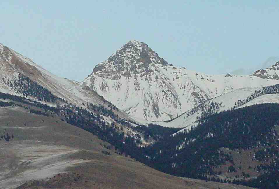 |
| Standhope Peak 11,878 feet |
 |
||||||||
| Traditional Climbing Route
(Broad Canyon)
Jumpoff Point: Broad Canyon Trailhead
Elevation of Summit: 11,878 feet Total Elevation Gain: 4,078 feet Total Distance (one - way): 8 miles Climbing Information:
Alternate Climbing Route (Fall Creek)
Elevation of Summit: 11,878 feet Total Elevation Gain: 4,678 feet Total Distance (one - way): 8 miles Climbing Information:
Thispage was created with the assistance of Tanner Mangam |
|||||||||
USDA Forest Service - Salmon-Challis National Forest
Last Modified: Tuesday, 18 December 2007 at 11:23:38 EST