The content of the ARM website is available to any browser, but for the best experience we highly recommend you upgrade to a standards-compliant browser such as Firefox, Opera or Safari.
Research Spotlight
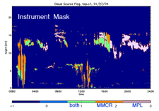
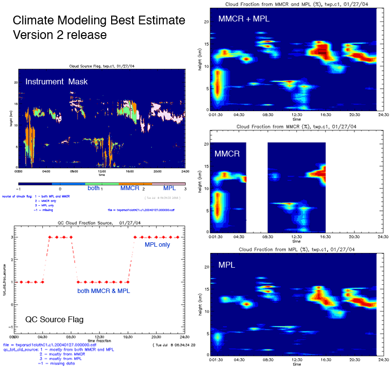
Second Version of Long-Term Climate Modeling Best Estimate Data Released
With major improvements in the cloud fraction, cloud liquid water path (LWP), precipitable water vapor (PWV), and surface radiative fluxes, a new version of the "Climate Modeling Best Estimate" (CMBE) is now available from the ARM Climate Research Facility (ACRF) Archive. This data set, specifically tailored for use in evaluating global climate models, includes long-term best estimates from 11 selected ACRF measurements and now encompasses data from the ACRF sites in Barrow, Alaska; Nauru Island; Manus Island, Papua New Guinea; and Darwin, Australia; and the Southern Great Plains (SGP) site in Lamont, Oklahoma. A summary of all the changes in version 2 can be found on the CMBE web page.
To access these data, log in to the Data Archive. To request an account, go here. (Please contact the Archive if you have any login questions.)
Research Spotlight
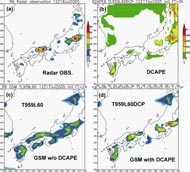
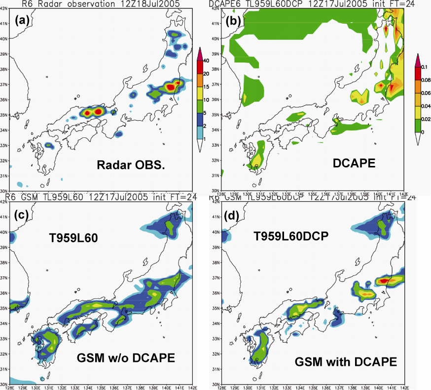
Revised Convective Triggering Mechanism Improves Precipitation Forecast
An improved convective triggering mechanism developed by ARM scientists
based on ARM observations was implemented recently in the Global
Spectral Model at the Japan Meteorological Agency (JMA) to improve
surface precipitation forecasts. The revised triggering mechanism uses a
dynamic convective available potential energy generation rate (DCAPE) to
control the onset of deep convection. It assumes that deep convection
occurs only when the large-scale dynamic forcing makes a positive
contribution to the existing positive CAPE, i.e., DCAPE >0. This simple
dynamic constraint emulates the collective effects of lower-level
moistening and upward motion of the large-scale circulation.
With the new triggering mechanism, the revised JMA's Global Spectral
Model with T959 truncation and 60 vertical levels (T959L60DCP)
substantially reduced the precipitation bias in the original Global
Spectral Model (T959L60).
For more information, read the research highlight.
Research Spotlight
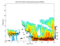
Black Forest, Germany, WACR- ARSCL Evaluation Products Now Available
Observations from the 95 GHz W-band ARM Cloud Radar (WACR), Micropulse Lidar, and ceilometer have been combined using the new WACR-Active Remote Sensing of Clouds (WACR-ARSCL) value-added process (VAP) (Kollias and Miller, 2007) to produce cloud boundaries and time-height profiles of cloud location, radar moments, and linear depolarization ratio fields for the ARM Mobile Facility deployment in Heselbach, Germany (3/29/2007 – 1/2/2008). The basic algorithm used in the WACR-ARSCL VAP is similar to that employed by the ARSCL VAP, which is based on 35-GHz Millimeter Cloud Radar observations (Clothiaux et al., 2000).
These data are available as an ARM evaluation product from the ACRF Data Archive. Please contact the Archive if you have any login questions.
2010 ACRF Field Campaigns Selected
Recently announced ACRF field campaigns for 2010 will examine a variety of clouds types—cirrus, marine, and mixed-phase clouds—from the Arctic to the Azores. Read the Department of Energy press release for more information.
More upcoming field campaigns
Atmospheric Radiation Measurement Program
The Atmospheric Radiation Measurement (ARM) Program is the largest global change research program supported by the U.S. Department of Energy. The primary goal of the ARM Program is to improve the treatment of cloud and radiation physics in global climate models in order to improve the climate simulation capabilities of these models.
To achieve this goal, ARM scientists and researchers around the world use continuous data obtained through the ARM Climate Research Facility. This scientific user facility provides a unique asset for interdisciplinary global change research among the national and international scientific community.
About ARM