|
|
|
 In response to the global challenge, for a systematic conservation planning approach to MPA establishment,
set by the Convention on Biological Diversity and other international agreements and action plans, there are
now many initiatives to develop ecologically representative MPA networks. This report describes the progress
being made in 30 national and 35 sub-national ecological MPA network initiatives, using information from the
literature, MPA practitioners and planners, and conservation experts. The report explores the diverse range of
approaches applied, at various spatial and geographical scales, to demonstrate how MPA networks can be
established in practice, and how they can be adapted to different needs and priorities.
This report aims to promote a better understanding of the underlying principals and scientific basis behind
MPA network design, while disseminating experiences and lessons learned from the initiatives underway at
regional national and sub-national levels. The report concludes with a series of six recommendations for the
establishment of effective MPA networks, which build on these experiences to capture the complex range of
considerations in this rapidly evolving field.
The report is a joint publication between UNEP-WCMC and the UNEP Regional Seas Programme, and was written by Sue Wells, in collaboration with Victoria Sheppard and Hanneke van Lavieren, with support from Nicola Barnard, Francine Kershaw, Colleen Corrigan, Kristian Teleki, Penny Stock and Ellik Adler. The report was launched at the "International Coral Reef Marine Protected Area Network Meeting / 4th ICRI East Asia Regional Workshop" on 17-19th November 2008 in Tokyo, Japan.
The report can be downloaded from the UNEP-WCMC One Ocean Programme website
|
|
|
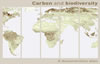 The 24 page demonstration atlas, launched at the 14th Conference of the Parties to the United Nations Framework Convention on Climate Change, shows that areas high in both carbon and biodiversity do exist and can be identified by relatively simple mapping tools. Prioritising such areas could give the 'double benefit' of reducing emissions from land use change whilst conserving biodiversity. Three regional maps along with six national maps are shown for the tropics, derived from global-scale data.
Achim Steiner, UN Under-Secretary General and UNEP Executive Director, said: "At a time of scarce financial resources and economic concerns, every dollar, euro or yen needs to deliver double, triple even quadruple dividends. Intelligent investment in forests in developing countries is a key example".
By demonstrating the potential for such 'win win' areas to be identified, the atlas could have particular input to the current discussions on reducing emissions from deforestation in developing countries (REDD).
These new maps are just a first step towards demonstrating how combining different types of data can help to identify areas where opportunities and benefits overlap for storing carbon and protecting biodiversity. A new, detailed and web-based atlas is expected in 2009 in the run up to UN climate meeting in Copenhagen. The atlas will cover a larger number of countries with more accurate, national data on carbon and biodiversity where available, and examine options to include ecosystem services and impacts on local livelihoods. As emphasised by Mr Steiner, ensuring safeguards for local and indigenous people will be paramount to a successful REDD.
Full details of the press release can be found here
The atlas can be downloaded here as a screen friendly version, or as a printable version. The atlas is also available as hard copy or as a CD upon request.
Please contact barney.dickson@unep-wcmc.org for further information regarding the demonstration atlas, or alison.campbell@unep-wcmc.org to request copies.
|
|
|
A new study published in Conservation Letters finds that protection of marine habitats is lagging far behind that of terrestrial areas. While 12 percent of the world's lands are protected, only 4 percent of the world's coastal waters fall within "marine protected areas," a conservation tool used around the world to preserve ocean resources.
"Unfortunately, we found that great swathes of the world's coastal waters are unprotected, meaning coastal livelihoods, incomes and food supplies are all at risk as fish stocks fall and coastlines erode," said Mark Spalding, senior marine scientist at The Nature Conservancy and lead author of the study. "The good news is that marine protected areas can be a powerful tool to ensure that ocean habitats remain healthy and productive for future generations - but we need to expand and strengthen protection efforts now."
The study was a collaboration between The Nature Conservancy (TNC), UNEP-WCMC and IUCN. As part of this study, spatial analysis was conducted at UNEP-WCMC using the marine classification system of coastal ecoregions (developed by TNC, the World Wildlife Fund and other partners) and a global marine protected areas dataset. The study examined the protection status for each of the world's varied coastal ecoregions (geographically and scientifically similar areas), but also expanded its vision out to the open oceans.
To read more about this study please see the press release
The marine protected areas dataset used in this study is now part of the World Database on Protected Areas (WDPA), hosted and managed by UNEP-WCMC. A joint project of UNEP and IUCN, the WDPA is the most comprehensive global spatial dataset on marine and terrestrial protected areas available, see www.wdpa.org.
|
|