USGS - science for a changing world

Montana Water Science Center

home information/data projects publications droughtwatch contact

Picture of the main Montana Water Science Center office.


CURRENT CONDITIONS

Current streamflow conditions in Montana.

Current streamflow conditions map.
View a detailed map.

DATA CENTER

USGS IN YOUR STATE

USGS Water Science Centers are located in each state.

There is a USGS Water Science Center office in each State. Washington Oregon California Idaho Nevada Montana Wyoming Utah Colorado Arizona New Mexico North Dakota South Dakota Nebraska Kansas Oklahoma Texas Minnesota Iowa Missouri Arkansas Louisiana Wisconsin Illinois Mississippi Michigan Indiana Ohio Kentucky Tennessee Alabama Pennsylvania West Virginia Georgia Florida Caribbean Alaska Hawaii New York Vermont New Hampshire Maine Massachusetts South Carolina North Carolina Rhode Island Virginia Connecticut New Jersey Maryland-Delaware-D.C.

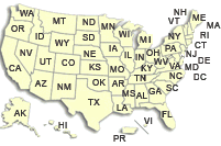
Hydrologic Information and Data for Montana

The U.S. Geological Survey currently operates about 400 data collection sites in Montana for acquiring information on surface-water, ground-water, water-quality, and precipitation. Many of these sites are equipped with satellite telemetry, which provides real-time data via GOES satellites and downlinks, which enables the posting of data to the Web for public dissemination.

Surface-water information and data.

Surface Water

Investigate Montana's surface-water resources.

USGS's National Water Information System.

NWISWeb

Find real-time and historical water data from USGS's National Water Information System.

Ground-water information and data.

Ground Water

Find out more about Montana's ground-water resources. Ground water serves many uses in Montana.

Water-montioring sites in Montana.

Site Data

View lists and information about water-montioring sites in Montana.

Water-quality information and data.

Water Quality

Find out more about the quality of Montana's water resources.

USGS WaterWatch system.

WaterWatch

Maps, graphs, and tables describing streamflow conditions for the United States.

GIS Data.

GIS Data

Montana's geographic information systems resources.

USGS Home Water Resources Biology Geography Geology Geospatial

Accessibility FOIA Privacy Policies and Notices

Take Pride in America logo USA.gov logo U.S. Department of the Interior | U.S. Geological Survey
URL: http://mt.water.usgs.gov/infodata/index.html
Page Contact Information: webmaster-mt@usgs.gov
Page Last Modified: Friday, 19-Sep-2008 10:37:43 EDT