Los Alamos is assisting in the Hurricane Katrina situation, both in the air and in the realm of virtual reality. On-scene in the Gulf Coast area, Laboratory spectroscopic equipment is airborne on the EPA's ASPECT plane and scientists are analyzing the data, while closer to home the critical infrastructure modeling teams of Decision Applications (D) Division have been hard at work.
ASPECT
The ASPECT plane, an airborne toxin-detection platform operated by Los Alamos and the U.S. Environmental Protection Agency, has been deployed to the Katrina disaster area, with two tasks:
• scanning for toxic chemicals in the air from chemical tank damage, and
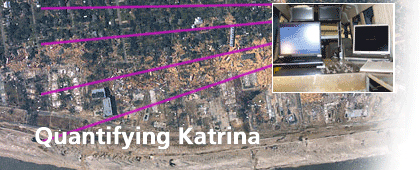
• to take imagery linked to GPS data for the Federal Emergency Management Agency to provide detailed, mapped information about levels of damage in specific, hard-to-reach areas across the Gulf Coast.
INFRASTRUCTURE MODELING
Prior to Katrina's landfall both the U. S. Department of Homeland Security's National Infrastructure Simulation and Analysis Center (NISAC) and the U.S. Department of Energy's Office of Energy Assurance (OEA) were activated to provide impact predictions for Katrina. Los Alamos maintains teams to assist both organizations with detailed computer models of vulnerable power lines and stations, flooding effects on power systems and more. Los Alamos continues to provide ongoing analyses as flooding and restoration in the hurricane's aftermath continues.
