|
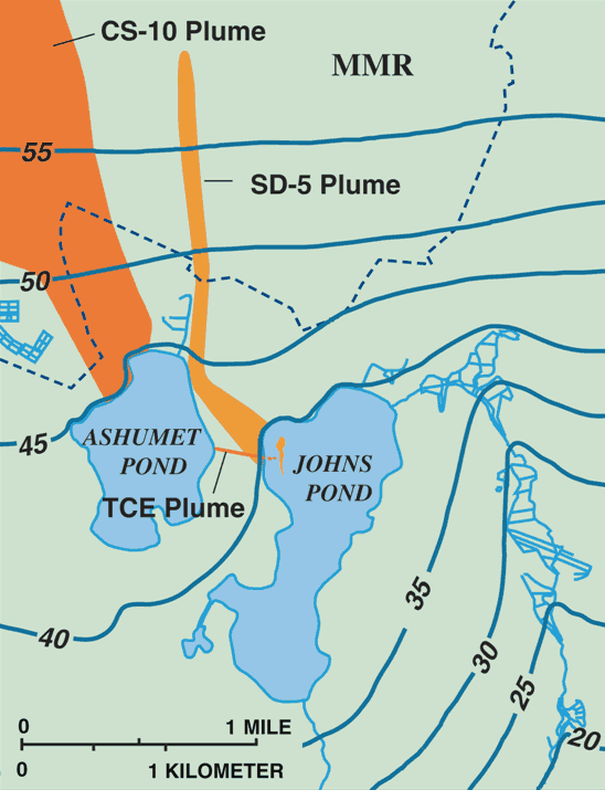
Map of the chemical spill-10 (CS-10) and storm drain-5 (SD-5) plumes on the Massachusetts Military Reservation (MMR) and the discharge areas in Johns Pond, Cape Cod, Massachusetts. Contour lines are water-table elevations in feet above sea level -- from the Passive-Vapor-Diffusion Sampler Photo Gallery
|