
STATEMAP Projects
Document Actions
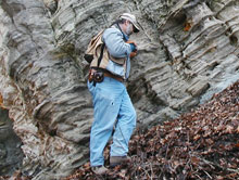 Missouri Geological Survey and Resource Assessment Division Geologist Chris Vierrether examines huge slump block of Ordovician age St. Peter Sandstone. |
The NCGMP is currently funding 127 projects from 45 states. These projects include both bedrock and surficial geologic mapping, and digital compilation of geologic maps. In recent years, STATEMAP efforts have focused primarily on geologic maps that address water, aggregate, and mineral resources; and landslide and earthquake hazards. As shown in the chart, these maps are used less widely to address issues such as flooding, radon, and mine subsidence hazards; and ecosystem and wetland issues. |
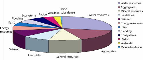
Chart showing projected uses for STATEMAP geologic maps and studies.
More detailed map-based information about these projects is contained in the NCGMP-Funded Geologic Mapping and Related Studies database.
Created by
admin
Last modified 08-02-2007 07:21
Last modified 08-02-2007 07:21

