|
|
projects > salinity patterns in florida bay: a synthesis
Salinity Patterns in Florida Bay: A Synthesis
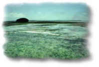
Salinity in Florida Bay and its relationship to climate and water management in south Florida is central to restoration activities in Florida Bay. Upstream water management activities over the last century have disrupted the quantity, quality, timing and distribution of freshwater flows into Florida Bay affecting salinity conditions. Long-term (e.g., marinification) and short-term (e.g., hypersalinity, freshets) effects of salinity are integral elements of conceptual models of seagrass die-off. Loss of seagrass habitat beginning with seagrass die-off in 1987 is implicated in the changes in sediment dynamics, nutrient dynamics and nursery function characterizing the Bay over the last decade. Detailed paleoecological studies are underway to reconstruct salinity conditions in a pre-management Florida Bay as a possible restoration target. Hydrodynamic models (RMA 10, FATHOM, SWIFT2D) are being developed for Florida Bay to aid in predicting circulation, inflow and the movement of nutrients through the system. All these studies require salinity data and synthesis for calibration, verification and interpretation. Despite these needs present and past spatial and temporal patterns of salinity in Florida Bay have not been summarized. At this time direct salinity observations from within Florida Bay extend from 1936 to the present. Anecdotal references to salinity conditions within the Bay are known to exist from as early as 1908 within the scientific literature. Spatially extensive data are available from the mid-1950s. The historic salinity data for the Bay and its immediate environs has been compiled from all sources into a single database relating each observation to time and place (Robblee et al., 1989). Since the early 1980s salinity has been monitored continuously by Everglades National Park at an increasing number of stations in the Bay. The ENP database includes related data (e.g., rainfall, water level, etc.) for Florida Bay and adjacent waters as well as the Bays headwaters in the Everglades (Smith, NPS). More recently (since 1994) bimonthly spatially intensive salinity surveys have been conducted by the US Geological Survey within Florida Bay (Halley, USGS). This project will combine these data sets and available anecdotal data into a synthesis of salinity conditions within Florida Bay from 1900. During the first year these databases will be completed, QA/QC will be performed, and data entry into a relational database including other relevant physical data (rainfall, evaporation, flow, etc.) searchable by time, location and depth will begin. During year two a synthesis of salinity patterns in the Bay including relationships between salinity and freshwater inflow and rainfall will be completed using this relational database. (Note: this is a new project starting in 1999.) ProposalsProject SummariesPublicationsAbstracts
Flyers
Posters
|
U.S. Department of the Interior, U.S. Geological Survey
This page is: http://sofia.usgs.gov/projects/index.php?project_url=sal_patterns
Comments and suggestions? Contact: Heather Henkel - Webmaster
Last updated: 06 January 2009 @ 12:29 PM (BJM)