|


|
|
 From May 22 to
June 4, 2006 scientists from Olympic Coast National Marine Sanctuary, other NOAA organizations
and other research partners explored areas of the sanctuary looking for communities of
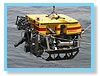
deepwater corals and sponges. Using the ROPOS remotely-operated-vehicle (ROV) they traveled
over the seafloor at depths ranging from 100 to 650 meters (~300 to 2000 feet) During eleven
dives they covered more than 15 study locations both inside and outside the
Essential Fish Habitat Conservation Area recently established by the Pacific
Fishery Management Council. The
Conservation Area in Olympic Coast National Marine Sanctuary went into effect on June 12,
2006, closing the area to bottom trawling. The Conservation Area in the sanctuary covers
159.4 square nautical miles, or about 15 percent of the sanctuary. The 2004 discovery of
Lophelia pertusa in the sanctuary was a factor in the Council's decision on the boundaries of
the Conservation Area.
From May 22 to
June 4, 2006 scientists from Olympic Coast National Marine Sanctuary, other NOAA organizations
and other research partners explored areas of the sanctuary looking for communities of
deepwater corals and sponges. Using the ROPOS remotely-operated-vehicle (ROV) they traveled
over the seafloor at depths ranging from 100 to 650 meters (~300 to 2000 feet) During eleven
dives they covered more than 15 study locations both inside and outside the
Essential Fish Habitat Conservation Area recently established by the Pacific
Fishery Management Council. The
Conservation Area in Olympic Coast National Marine Sanctuary went into effect on June 12,
2006, closing the area to bottom trawling. The Conservation Area in the sanctuary covers
159.4 square nautical miles, or about 15 percent of the sanctuary. The 2004 discovery of
Lophelia pertusa in the sanctuary was a factor in the Council's decision on the boundaries of
the Conservation Area.
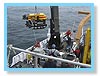
 This research
cruise was on the 224-foot NOAA ship McArthur II, with a crew and officers of 15, and
14 scientists and ROV operators. Operations were conducted around the clock to maximize ROV
dive time. Because of the expense of mobilizing a large ship and ROV, NOAA scientists try to
use every moment to study the sanctuary. The scientists and ROV crew worked two 12 hour
shifts. Although rough weather was forecast, we only had to reposition twice due to
weather - these were the dives in the relatively calmer waters of the Strait of Juan de
Fuca.
This research
cruise was on the 224-foot NOAA ship McArthur II, with a crew and officers of 15, and
14 scientists and ROV operators. Operations were conducted around the clock to maximize ROV
dive time. Because of the expense of mobilizing a large ship and ROV, NOAA scientists try to
use every moment to study the sanctuary. The scientists and ROV crew worked two 12 hour
shifts. Although rough weather was forecast, we only had to reposition twice due to
weather - these were the dives in the relatively calmer waters of the Strait of Juan de
Fuca.
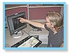
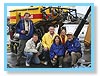 Principal investigators for this deep-sea cruise were Ed Bowlby (OCNMS), Mary Sue Brancato
(OCNMS) and Jeff Hyland (National Centers for Coastal Ocean Science). Additional scientists
included Curt Whitmire (NOAA, Northwest Fisheries Science Center) and Peter Etnoyer
(Aquanautix Consulting), and Outreach and Education Coordinator Robert Steelquist (OCNMS).
Two of the video cameras and a 3-beam laser system to quantify the area surveyed (Jagielo
et
al. 2004) were provided by Washington Department of Fish and Wildlife as a pilot to try
onboard the ROPOS ROV and WDFW shore-based staff support was provided by Farron Wallace and Eric
Eisenhardt.
Principal investigators for this deep-sea cruise were Ed Bowlby (OCNMS), Mary Sue Brancato
(OCNMS) and Jeff Hyland (National Centers for Coastal Ocean Science). Additional scientists
included Curt Whitmire (NOAA, Northwest Fisheries Science Center) and Peter Etnoyer
(Aquanautix Consulting), and Outreach and Education Coordinator Robert Steelquist (OCNMS).
Two of the video cameras and a 3-beam laser system to quantify the area surveyed (Jagielo
et
al. 2004) were provided by Washington Department of Fish and Wildlife as a pilot to try
onboard the ROPOS ROV and WDFW shore-based staff support was provided by Farron Wallace and Eric
Eisenhardt.
We made eleven dives primarily along the outer coast, between one and 20 miles offshore.
Two dives were in the Strait of Juan de Fuca within the sanctuary boundaries. One dive was at
the head of the Juan de Fuca Canyon, one of three submarine canyons in the sanctuary. Dive
targets included boulder patches, walls and bedrock - areas previously identified using side
scan sonar data as rock habitat.
Take a short virtual dive with us!
 Researchers
saw coral and sponge communities within 14 of the 15 areas surveyed, as well as other areas
of the sanctuary. We shot hundreds of hours of video (one dive was 52 hours long!), thousands
of photographs, and collected more than 100 samples. The ROV was equipped with four video
cameras, one digital still camera, two manipulator arms, a core sampler, suction sampler and a
"biobox" to store samples. The wealth of data will be analyzed over the next year to
characterize the distribution, abundance and diversity of these resources; to evaluate their
vulnerability to human activity and other potential environmental risks; and to provide
new information to help support future resource management decision-making within OCNMS.
The data will be peer-reviewed and used in reports, papers and discussions with fisheries
co-managers including NOAA Fisheries, Pacific Fisheries Management Council,
the Makah, Quileute, and Hoh Indian tribes and the Quinault
Indian Nation, and Washington State.
Researchers
saw coral and sponge communities within 14 of the 15 areas surveyed, as well as other areas
of the sanctuary. We shot hundreds of hours of video (one dive was 52 hours long!), thousands
of photographs, and collected more than 100 samples. The ROV was equipped with four video
cameras, one digital still camera, two manipulator arms, a core sampler, suction sampler and a
"biobox" to store samples. The wealth of data will be analyzed over the next year to
characterize the distribution, abundance and diversity of these resources; to evaluate their
vulnerability to human activity and other potential environmental risks; and to provide
new information to help support future resource management decision-making within OCNMS.
The data will be peer-reviewed and used in reports, papers and discussions with fisheries
co-managers including NOAA Fisheries, Pacific Fisheries Management Council,
the Makah, Quileute, and Hoh Indian tribes and the Quinault
Indian Nation, and Washington State.
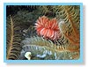
 We found at least 17 coral species and numerous sponges, including the reef building sponge
Farrea occa. The stony coral, Lophelia pertusa, common in the North Atlantic Ocean,
but rarely found in the North Pacific, was documented
at several sites surveyed in the sanctuary - reconfirming the discovery of this
coral in this area by NOAA scientists in 2004. Soft corals included the gorgonians
Paragorgia, Swiftia, Primnoa, and Callogorgia and at least five
species of sea pens. Stony
corals or Scleractinia included Lophelia, Desmophyllum and Balanophyllia.
The hydrocorals we
observed included at least two species of Stylaster. In addition to the corals and
sponge
communities, we saw a multitude of invertebrate and fish species. Over the next several
months the samples and photos will be sent to experts in the various taxonomic areas to
confirm species identifications.
We found at least 17 coral species and numerous sponges, including the reef building sponge
Farrea occa. The stony coral, Lophelia pertusa, common in the North Atlantic Ocean,
but rarely found in the North Pacific, was documented
at several sites surveyed in the sanctuary - reconfirming the discovery of this
coral in this area by NOAA scientists in 2004. Soft corals included the gorgonians
Paragorgia, Swiftia, Primnoa, and Callogorgia and at least five
species of sea pens. Stony
corals or Scleractinia included Lophelia, Desmophyllum and Balanophyllia.
The hydrocorals we
observed included at least two species of Stylaster. In addition to the corals and
sponge
communities, we saw a multitude of invertebrate and fish species. Over the next several
months the samples and photos will be sent to experts in the various taxonomic areas to
confirm species identifications.
Project Overview
 Preparing for the ROV cruise, the research team targeted areas of known potential coral-sponge
habitat by reviewing, as a primary data source, side-scan sonar data for hard substrate
features within the sanctuary at depths corals have generally been reported (>80m). Some of
the side-scan sonar data were collected on a sister cruise to the ROV expedition, in April
2006, also aboard the NOAA ship McArthur II. Principal Investigator Steve Intelmann
(OCNMS)
conducted an 11-day side-scan sonar survey in the sanctuary. This information, along with
previous side-scan sonar surveys from the sanctuary, were reviewed by OCNMS scientists to
locate potential dive targets for coral-sponge habitat. For our planning maps, we drew
polygons around the features to identify them as target dive sites.
Preparing for the ROV cruise, the research team targeted areas of known potential coral-sponge
habitat by reviewing, as a primary data source, side-scan sonar data for hard substrate
features within the sanctuary at depths corals have generally been reported (>80m). Some of
the side-scan sonar data were collected on a sister cruise to the ROV expedition, in April
2006, also aboard the NOAA ship McArthur II. Principal Investigator Steve Intelmann
(OCNMS)
conducted an 11-day side-scan sonar survey in the sanctuary. This information, along with
previous side-scan sonar surveys from the sanctuary, were reviewed by OCNMS scientists to
locate potential dive targets for coral-sponge habitat. For our planning maps, we drew
polygons around the features to identify them as target dive sites.
 Side scan coverage of the sanctuary is incomplete - only about 20 percent of the sanctuary has
been mapped using side scan sonar. The majority of the potential
ROV dive sites occurred within the 20 percent of the mapped area of the sanctuary. We
selected a few additional sites in the canyon heads to expand the depth range since some corals
(e.g., black corals) generally occur in deeper waters. These sites were picked based on
depth, slope and a designation as an "untrawlable" area as defined by NOAA Fisheries scientist
Mark Zimmermann (2003) and/or Washington Department of Fish and Wildlife Scientists
(Jagielo
et al. 2004). In addition to the side-scan sonar imagery, we reviewed bathymetry for all
of
the sites, prioritizing sites, only by depth and not slope. From this process, we identified
48 potential dive sites as the sample population, defined as the area of known potential
coral/sponge habitat with known trawling history.
Side scan coverage of the sanctuary is incomplete - only about 20 percent of the sanctuary has
been mapped using side scan sonar. The majority of the potential
ROV dive sites occurred within the 20 percent of the mapped area of the sanctuary. We
selected a few additional sites in the canyon heads to expand the depth range since some corals
(e.g., black corals) generally occur in deeper waters. These sites were picked based on
depth, slope and a designation as an "untrawlable" area as defined by NOAA Fisheries scientist
Mark Zimmermann (2003) and/or Washington Department of Fish and Wildlife Scientists
(Jagielo
et al. 2004). In addition to the side-scan sonar imagery, we reviewed bathymetry for all
of
the sites, prioritizing sites, only by depth and not slope. From this process, we identified
48 potential dive sites as the sample population, defined as the area of known potential
coral/sponge habitat with known trawling history.
 For this research, we used a stratified random approach to prioritize sites. The 48 sites
were stratified into four strata: 1) trawled and inside the EFH Conservation Area; 2) trawled
and outside the EFH Conservation Area; 3) not trawled and inside EFH Conservation Area; and 4)
not trawled and outside the EFH Conservation Area. However, without a more comprehensive
evaluation of the side-scan sonar data, one of these four strata yielded no potential dive
sites (trawled and outside closure area). This may be due to the fact that the coral-sponge
stratum is incomplete at this time with only about 20 percent of the sanctuary mapped. Half
of the polygons within each strata were randomly selected for sampling this year, and about
one third of the sites were successfully surveyed on this cruise, with the intention of
sampling the remainder of the polygons at a future sampling date. The sites were stratified
as inside trawlable or untrawlable habitat as identified by NOAA Fisheries (Zimmermann
2003)
and WDFW (Jagielo et al 2004).
For this research, we used a stratified random approach to prioritize sites. The 48 sites
were stratified into four strata: 1) trawled and inside the EFH Conservation Area; 2) trawled
and outside the EFH Conservation Area; 3) not trawled and inside EFH Conservation Area; and 4)
not trawled and outside the EFH Conservation Area. However, without a more comprehensive
evaluation of the side-scan sonar data, one of these four strata yielded no potential dive
sites (trawled and outside closure area). This may be due to the fact that the coral-sponge
stratum is incomplete at this time with only about 20 percent of the sanctuary mapped. Half
of the polygons within each strata were randomly selected for sampling this year, and about
one third of the sites were successfully surveyed on this cruise, with the intention of
sampling the remainder of the polygons at a future sampling date. The sites were stratified
as inside trawlable or untrawlable habitat as identified by NOAA Fisheries (Zimmermann
2003)
and WDFW (Jagielo et al 2004).
 We also attempted to classify the sites by fishing intensity using logbook trawl set-points,
however, this did not prove to be high enough resolution data. On board the cruise, NOAA
Fisheries scientist Curt Whitmire used additional logbook data to perform a density algorithm
so that the dive sites could be classified into low or high trawl intensity. These
intensities were assigned to the already randomly selected sites.
We also attempted to classify the sites by fishing intensity using logbook trawl set-points,
however, this did not prove to be high enough resolution data. On board the cruise, NOAA
Fisheries scientist Curt Whitmire used additional logbook data to perform a density algorithm
so that the dive sites could be classified into low or high trawl intensity. These
intensities were assigned to the already randomly selected sites.
In addition to this stratified random approach to dive site selection, sites within the Strait
of Juan de Fuca were selected as "weather sites" to allow ROV dives to continue if the winds
off the coast (but not in the relatively sheltered Strait) prevented launch and recovery of
the ROV. With these sites the number of potential dive sites totaled 55.
We also evaluated bycatch data from NOAA Fisheries but because NOAA Fisheries (L. Clark and
C.
Whitmire pers. comm. 2006) indicated inconsistent reporting of bycatch by observers, this
information was not used prioritize potential dive sites.
 The sites selected were surveyed by video transect and digital photography. The video
transects will be randomly or systematically sampled during post-processing to answer the
research questions. The sample units obtained during post-processing will include items such
as the following: enumeration of megafauna, living/dead, broken/whole, size (area and
height), and evidence of fishing activity (gear, tracks, etc.). This survey pattern allowed
for non-statistical objectives (e.g., Locate coral and sponge assemblages in the sanctuary) to
be addressed as well those with a research question (e.g., Is the species
diversity/abundance/richness of non-coral species different in coral areas than in adjacent
areas without corals?).
The sites selected were surveyed by video transect and digital photography. The video
transects will be randomly or systematically sampled during post-processing to answer the
research questions. The sample units obtained during post-processing will include items such
as the following: enumeration of megafauna, living/dead, broken/whole, size (area and
height), and evidence of fishing activity (gear, tracks, etc.). This survey pattern allowed
for non-statistical objectives (e.g., Locate coral and sponge assemblages in the sanctuary) to
be addressed as well those with a research question (e.g., Is the species
diversity/abundance/richness of non-coral species different in coral areas than in adjacent
areas without corals?).
Dowload the full cruise report, Observations of Deep Coral and Sponge Assemblages in Olympic Coast National Marine Sanctuary, Washington.
(Pdf format, 3.1 Mb)
Jagielo, T., J. Tagart, F. Wallace and S. Wang. Density of demersal groundfish in
untrawlable
habitat on the continental shelf of Washington.
Zimmermann, M. 2003. Calculation of untrawlable areas within the boundaries of a bottom
trawl
survey. Can. J. Fish. Aquat. Sci. 60:657-669.
For more information contact one of the principal investigators:
Ed.Bowlby@noaa.gov
Mary.Sue.Brancato@noaa.gov
Jeff.Hyland@noaa.gov
|
|

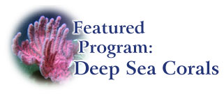
Deep Sea Coral Photo Gallery
More Photos from the Coral Cruise
Dive Diaries
Coral Ghost Town
The Wall, the Wave, and the Weird
Snow Angels
Why Here and Not There?
More About Coral
Coral Habitat
Deep Sea Coral Habitat Mapping
What Are Deep Sea Corals?
Science Through Partnerships
Explorers
Archived Featured Programs:
CSCAPE
COASST
|


