|
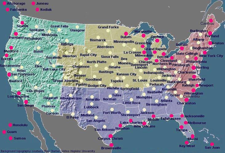 Marine Forecast Offices and Centers provide links
to their products as well as additional regionally focused
information. Click on map for links.
Marine Forecast Offices and Centers provide links
to their products as well as additional regionally focused
information. Click on map for links.
Our marine webpages will be redesigned over the coming year.
If there's something you like, dislike, or would like to see, please send your comments to
marine.weather@noaa.gov
NATIONAL WEATHER SERVICE MARINE PRODUCTS VIA INTERNET
The Internet is not part of the National
Weather Service's operational data stream and should never be relied upon
as a means to obtain the latest forecast and warning data. Become familiar with
and use other means such as NOAA Weather Radio
to obtain the latest forecasts and warnings. Please read
our disclaimer.
Note: Any reference to a commercial product or service does
not imply any endorsement by the National Weather Service as to function
or suitability for your purpose or environment.
Marine Text Forecasts and Products
The majority of National Weather Service (NWS) forecasts and warnings
may be found under the NWS webpage.
Of specific interest to mariners are the NWS Marine
Text Forecasts and Products. For convenience, High Seas, Offshore and
Coastal marine forecasts are subdivided by sea area or zone and available
via the Internet using our text interface or graphic interface. Individual
NWS Forecast Offices and Centers producing marine forecasts provide links
to their products as well as additional regionally focused information
(see map above).
Marine Graphic Forecasts and Products
Graphic marine forecasts are produced by NWS for broadcast via radiofax
and also made available via the Internet at Marine Radiofax Charts
.
The National Weather Service also plans to make available marine forecast data in gridded and vector formats for display on electronic charts and use by other value-added applications. Graphics using these data are available via the Internet for most U.S. coastal areas. See Marine News - Gridded and Vector Data. Gridded forecast data for offshore and hig seas areas are forthcoming.
Also see Computer Generated
Model Guidance below.
Satellite and RADAR Imagery
Satellite imagery may be found on the GOES
webpage. and is also available from NASA.
Ocean surface winds and other data derived from polar orbiting and geostationary
satellites may be found on NOAA's
Marine Observing Systems Team Homepage and NOAA's
Coastwatch Homepage. Information and links to Sea Surface Temperature
Charts and Gulf Stream charts may be found on our FAQ
webpage. NEXRAD
Doppler Radar images are available on the Internet on the NWS
Homepage and local NWS Forecast Offices
homepages. NEXRAD Doppler Radar images may also be found on local cable
channels and the webpages of local media including TV stations, radio stations
and newspapers as well as others.
Ice Analysis, Forecasts and Iceberg Reports
Ice analyses, forecasts and iceberg reports are available from the
National Ice Center, the U.S.
Coast Guard's International Ice Patrol, and local
NWS marine forecast offices in areas such as Alaska
where ice is a concern. Ice forecasts and observations are also made available
as radiofax, text products
and computer generated model guidance.
Computer Generated Model Guidance
Computer generated model guidance products used by marine forecasters
is available from the Ocean Modeling
Branch, National Centers for Environmental Prediction, the Environmental Modeling
Center, the National
Ocean Service's Chesapeake Bay Operational Forecast System, and the
Great Lakes Coastal Forecasting System (GLCFS).
NCEP model data in graphic and gridded binary (GRIB)
form may be found on NCEP's N.O.M.A.D.S.
(NOAA Operational Model Archive Distribution System),
NOMADS3,
NOMADS5 and
NOMADS6 webservers.
The Weather
Charts webpage contains charts, intended as guidance to forecasters,
which can prove of value to mariners. Note: Several charts listed under "Weather Charts", which are no longer required to support NWS operations, may be terminated or made available at alternate sites. This should not include those which are broadcast by marine radiofacsimile.
Caution...these data have not been
validated by marine forecasters and may be misleading. Mariners should
use these data in conjunction with forecaster generated forecasts.
Marine Climatological Information
User-friendly climatological information for marine coastal areas may
be found in Appendix
B of the National Ocean Service's Coast Pilot's, volumes 1-9. These
appendices, which were prepared by the National
Climatic Data Center, also contain other useful meteorological information
such as conversion tables. Visit their webpage for further information.
The National Geospacial-Intelligence Agency now makes available
some of its Pilot Charts on-line.
Foreign Marine Forecasts
Links to foreign
meteorological services, and foreign marine meteorological services are available courtesy of the World
Meteorological Organization (WMO).
The WMO has also introduced an experimental GMDSS Webpage which, as a first step, provides links to worldwide meteorological bulletins and warnings issued for the high seas via SafetyNet.
Also try these Navy links https://www.fnmoc.navy.mil and https://www.navo.navy.mil and
"Computer Generated Model Guidance" above for data which is outside the area of U.S. marine forecast responsibility.
Buoy and Other Real-Time Observations
The latest coastal and offshore weather observations from NOAA fixed
and drifting data buoys and Coastal-Marine Automated Network (C-MAN) stations
may be found at the National Data Buoy
Center webpage. Real time meteorological and oceanographic observations
for several sites are also available from the Physical Oceanographic Real-Time
System (Ports).
PORTS is a program of the U.S. National
Ocean Service that supports safe and cost-efficient navigation by providing
ship masters and pilots with accurate real-time information required to
avoid groundings and collisions. Several
National Ocean Service tide gages are also equipped with ancillary meteorological
sensors. Regionally focused observation data may also be found on
the webpages of local
NWS Forecast Offices. Some marine observations may also be found on
our NWS Marine Product Listing and Schedule.
Historical and real-time beach temperature data is available from the NODC
Coastal Water Temperature Guide.
NOAA's Forecast Systems Laboratory (FSL) offers a Display of Surface Data from several government, commercial and voluntarily operated mesonets as well as observations of those of the Voluntary Observing Ship (VOS) Program and data buoys. Among these mesonets, are observing systems at several U.S. Coast Guard stations as part of the Homeland Security WeatherNet Network which is a
public-private partnership between AWS Convergence Technologies and NWS. A variety of marine observations may also be viewed on the National Ocean Service's nowCOAST Web Portal(BETA).
For mariners with a low speed Internet connection....... The latest buoy or C-MAN data may be retrieved via the Internet as in the following example where 44017 refers to buoy #44017. http://www.ndbc.noaa.gov/mini_station_page.php?station=44017
WEBCAMS
The advent of the Internet has brought about a new type of observation system popular with beachgoers, surfers, and others - the WEBCAM which displays live images of current conditions. To find WEBCAMS for marine areas use your favorite Internet search engine to search for such key words as
Beach Cams,
Surf Cams,
Coastal Cams,
Ocean Cams,
Port Cams and
Cruise Cams.
You may wish to refine your search by adding your geographic area to the search's key words.
Tide Predictions, Observations and Storm Surge Forecasts
Near
real-time Water Level Observations, and Predicted Tide Information for
the calendar year, are available from the National
Ocean Service. Read the NOS
Tides FAQ for further information on obtaining NOS tides and tidal
current data. Caution is urged in using tide data made available at
University and other webpages. This information may not be based on current
government data and be of unknown quality.
The National Weather Service's Cleveland Forecast Office makes available
a series of experimental
Great Lakes Water Levels Graphs, using National Ocean Service data, intended to be low speed connection friendly for Internet access by vessels
afloat.
Experimental, computer generated, Extratropical
Water Level Forecasts are available from the National Weather Service's
Meteorological Development Laboratory.
Status maps are provided to give the user a quick overview of a region.
Forecasts of storm surge produced as a result of a tropical storm or hurricane
are available from your local
NWS Forecast Office.
The National
Ocean Service's Chesapeake Bay Operational Forecast System(CBOFS) and The Port of New York and New Jersey Operational Forecast System (NYOFS)
have been created by NOS to provide the maritime community with improved short-term
predictions of water levels. Please be advised
that these predictions are based on a hydrodynamic model and, as such,
should be considered as computer-generated forecast guidance.
For Emergency Responders and Planners
NOAA's Office of Response and Restoration, National Ocean Service, offers a series of job aids and software to predict weather and ocean affects on the trajectory of hazardous materials such as oil spills. The information may be helpful for further applications as well.
Historic Weather Forecasts, Satellite Images and Oceanographic
Data
For historic weather forecasts, satellite images and oceanographic
data, contact the National Climatic Data Center and National Oceanographic
Data Center, found on our listing of Phone Numbers
and Addresses.
Observations from Mariners
All NWS marine forecasts rely heavily on the Voluntary
Observing Ship (VOS) program for obtaining meteorological observations.
Ship observations may also be found on the National
Data Buoy Center - Observations Search,
National
Data Buoy Center - Ships Observation Report,
NOAA's Forecast Systems Laboratory (choose maritime),
CoolWX,
SailWX.info,
Oceanweather,
and
Destinsharks
webpages.
The National Weather Service has a number of other volunteer observation programs including the SKYWARN, MAREP, MAROB, MARS, APRSWXNET/Citizen Weather Observer Program (CWOP) and the Cooperative Observer Program (COOP) which are of benefit to the marine community.
Marine Webpages
The Internet contains a great number of webpages of interest to the
mariner. Visit our Links page for a listing of
recommended webpages pertaining to Marine Weather. The U.S.
Coast Guard Maritime Telecommunications Information webpage contains
an excellent description of marine communication systems. There are also
many other Internet sites of interest to the mariner. Use one the Internet
search engines to search on topics such as "marine weather", "radiofax",
"radiofacsimile", "weather buoys", "tides", etc. The
NOAA Library provides an excellent listing of links to marine related
webpages within NOAA and elsewhere.
Marine Weather Publications On the Web
Many marine weather related government publications are available on
the Web. Visit our publications webpage for several
we recommend including our popular Marine Service Charts, the Weather Log
Magazine, and our listing of Worldwide Marine Radiofacsimile Broadcast
Schedules .
Internet Access for Mariners
Internet at sea can be problematic unless you stay within cellular
telephone range of shore. The maximum speed for cellular telephones is typically 14.4 Kbaud, however, a number of cellular service providers are now offering enhanced services with speeds in the range of 56 Kbaud - 144 Kbaud. Terrestrial wireless Internet services such as
those provided by
GoAmerica,
TeleSea,
and Motient,
are beginning to become available, however, these provide limited maritime
coverage.
These companies may employ
"Marine WIFI"
technology which is rapidly becoming popular at marinas and in favorite harbor areas.
Satellite services including Inmarsat,
Iridium,
Globalstar,
Thuraya,
Emsat,
ACeS,
tracNet/DirecPC,
Mobile
Satellite Ventures, Boatracs,
Orbcomm
,
Digital Seas International
,
and MTN
are available, however, costs are generally greater.
Several companies offer e-mail services designed to optimize satellite connectivity including
MAILASAIL,
MarineNet,
OCENS,
Telaurus,
UUPLUS
and
XGate
.
Full Internet
access is often available if you have a satellite terminal onboard, but
presently unless you restrict your use to e-mail messages, costs can be
high. A number of satellite services such as Inmarsat-C offer e-mail messaging
services only and provide no access to the World Wide Web. Several transmission
and data compression schemes are available and in development to make the
Web more accessible to the mariner. There are also several public FTP-to-EMAIL
and WWW-to-EMAIL servers available to allow Internet access for users who
do not have direct or cost effective access to the World Wide Web but who
are equipped with an e-mail system. CLICK HERE
for information. Low cost, worldwide, access to the World Wide Web via
satellite should be available to the mariner in the next five to ten years.
If you have an HF marine radio, E-mail service is available from companies such as Sailmail,
SeaMail,
CruiseEmail,
Global Marine Networks,
MarineNet Wireless,
Kielradio,
Globe
Wireless and Mobile
Marine Radio (WLO)/Telaurus.
E-mail can be accomplished at no cost using amateur
radio.
The domain of the Internet is rapidly expanding to now include wireless
devices such as so-called "Internet-Ready" digital cellular phones and
Personal Data Assistants (PDAs). These offer great potential for making
marine forecasts available to coastal mariners, who have limited other
options available. The majority of these other options are by voice where there is always
the possibility of misunderstanding.
A webpage for the most popular marine text forecasts compatible with many PDA's may be found at http://www.nws.noaa.gov/om/marine/marinewxi.htm.
Visit http://www.nhc.noaa.gov/aboutwap.shtml
where you will find NHC/TPC's wireless web page. There you can find the
link to obtain NHC/TPC's most popular hurricane products, offshore forecasts, and high seas forecasts.
A WAP webpage for compatible cellphones containg marine and public forecasts may be found at: cell.weather.gov NOW WITH GREATLY ENHANCED MARINE LINKS
(includes a capability to view the forecast for any zip/city and radar images).
Note....WAP/WML webpages require a WAP-capable cellphone or other WAP-capable device.
A low bandwidth webpage containing marine and public forecasts intended for mobile devices may be found at: mobile.weather.gov
(includes a capability to view the forecast for any zip/city and radar images).
A number of Cellular service providers are beginning to offer value-added Internet-like services which provide access to NOAA tide data, marine forecasts, and other items of interest to the wireless customer. These require a digital phone with some of the more advanced features. See your Cellular service provider for details. There may be a nominal fee required for using these services.
National Weather Service Products Available Via E-MAIL
(FTPMAIL)
National Weather Service marine text forecasts, radiofax charts
and buoy observations are available via e-mail. Further, FTPMAIL may be used to acquire any file on the tgftp.nws.noaa.gov FTP server. The FTPMAIL server is intended to allow Internet
access for mariners and other users who do not have direct access to the
World Wide Web but who are equipped with an e-mail system. Turnaround is
generally in under one hour, however, performance may vary widely and receipt
cannot be guaranteed. To get started in using the NWS FTPMAIL service,
follow these simple directions to obtain the FTPMAIL "help" file (11 KBytes),
or CLICK HERE.
An FAQ webpage describing several public and commercial FTP-to-EMAIL and
WWW-to-EMAIL servers may be found at:
www.faqs.org/faqs/internet-services/access-via-email/
A webpage describing several different e-mail "robots" similar in concept to FTPMAIL,
including some with advanced features such as allowing retrieval of NWS marine GRIB files, simple webpages, and
allowing products to be retrieved on a scheduled, recurring basis may be found at:
http://weather.noaa.gov/pub/fax/robots.txt
Internet Broadcasts
Marine weather data may also be obtained via the Internet using EMWIN
. As part of the New NOAA Weather Wire Service,
Computer Sciences Corporation
broadcasts the entire Weather Wire product stream on the Internet as a
commercial service.
Watches, Warnings and Advisories Using RSS and CAP XML
Based Formats
The National Weather Service provides access to watches, warnings and advisories for land areas, and for hurricane watches and warnings, via RSS and CAP/XML to aid the automated dissemination of this information. Planning is in progress to extend this to marine warnings.
Directories of NWS Marine Forecasts
For Website developers or other "power" users, many NWS marine text
forecast products are available at the following URL's, indexed by WMO
header or zone.
http://weather.noaa.gov/pub/data/forecasts/marine/
ftp://tgftp.nws.noaa.gov/data/forecasts/marine/
http://weather.noaa.gov/pub/data/raw/
ftp://tgftp.nws.noaa.gov/data/raw/
http://www.ndbc.noaa.gov/data/Forecasts/
http://www.weather.gov/data/
http://www.srh.noaa.gov/data
http://www.weather.gov/view/validProds.php
Many National Weather Service Weather Charts may be found in the following
directories, indexed by WMO ID or other identifier.
http://weather.noaa.gov/pub/fax/
ftp://tgftp.nws.noaa.gov/fax/
Change Notices
For details on changes to NWS products, visit the Office
of Climate, Water, and Weather Services Service Change Notifications, the Data
Product Change Management Status Reports , and NWS Telecommunication Operations Center (TOC) Data Management Change Notices webpages.
CLICK HERE for a summary of recent changes of most interest to mariners and coastal residents.
|