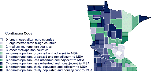
This map illustrates the application to Minnesota of a 10-tiered county-based classification of rurality. The darker the shading, the more "rural" the county is.
Note: MSA is metropolitan statistical area.
Data Source: Area Resource File, Office of Data Analysis and Management, Bureau of Health Professions, March 1992.