Alaska ShoreZone Coastal Mapping and Imagery
INTRODUCTION
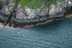
Southeast Alaska Lynn Canal shoreline.
Photo: NOAA Fisheries
The ShoreZone mapping system has been in use since the early 1980s and has been applied to more than 40,000 km of shoreline in Washington and British Columbia (Berry et al 2004; Howes 2001). Through partnerships with other agencies and organizations, portions of southeastern and central Alaska have been imaged and mapped. This project is funded by NOAA and a number of other agencies and organizations as listed below.
This standardized system catalogs both geomor-phic and biological resources at mapping scales of better than 1:10,000. The high resolution, attribute rich dataset is a useful tool for extrapolation of site data over broad spatial ranges and creating a variety of habitat models.
Low-tide-oblique aerial imagery sets this system apart from other mapping efforts. You can "fly the coastline" (video), view still photos, and access biophysical data using our interactive ArcIMS web-site. This site will include more of Alaska's coast-line as new data becomes available.
Fly the Coastline
Alaska Shorezone
- Shorezone Website: Display and query data about Alaska's shoreline habitat. NOTE : Website instructions and browser configuration requirements
- Shorezone Fact Sheet
- Metadata
- Mapping Protocol for the Gulf of Alaska
Additional ShoreZone Websites
ShoreZone Related Databases
Contacts
NOAA Fisheries Analytical Team
- Steve.Lewis@noaa.gov, (907) 586-7858
Habitat Conservation Division
- Cindy.Hartmann@noaa.gov, (907) 586-7585
- Linda.Shaw@noaa.gov, (907) 586-7510
Auke Bay Laboratory
- Mandy.Lindeberg@noaa.gov, (907) 789-6616
Shorezone Partners
- Alaska Department of Natural Resources
- Alaska Department of Fish and Game
- Cook Inlet Regional Citizens Advisory Council
- Exxon Valdez Oil Spill Trustee Council
- National Park Service
- The Nature Conservancy
- Ocean Fund
- Prince William Sound Regional Citizens Advisory Council
- Southeast Alaska Petroleum Resource Organization
- University of Alaska Fairbanks
- U.S. Fish and Wildlife Service
- U.S. Forest Service
Flight Logs and Reports
Southeast Alaska (SE)
- 2004 SE Flight Log
- 2004 SE Summary Report
- 2004-05 SE Summary Report
- 2005 SE Flight Log
- 2006 SE Flight Log
- 2006 Craig Flight Log
- 2006 Ketchikan Area Summary Report
- 2007 SE Flight Log
- 2008 SE Flight Log
- 2008 SE Icy Cape Flight Log
- 2008 Northern Admiralty Island, Peril Strait, and Tracy Arm
Prince William Sound (PWS)
- 2004 Western PWS Flight Log
- 2004 Western PWS Summary Report
- 2007 PWS Flight Log
- 2007 Copper River Delta Flight Log
Kodiak
Kenai
Bristol Bay
Related Reports
- Modeling habitat suitability for the invasive salt marsh cordgrass Spartinausing, ShoreZone coastal habitat mapping data in Southeast Alaska, British Columbia, and Washington State, December 2008 (external link)
- Evaluation of a Habitat Suitability Model for the Invasive European Green Crab (Carcinus maenas) Using Species Occurrence Data from Western Vancouver Island, British Columbia, July 2008
- Shorezone Habitat Capability Modeling: A study of potential suitable habitat for the invasive European green crab (Carcinus maenas) in Southeast Alaska, British Columbia, and Washington State, August 2007