USGS Multimedia Gallery
|
|
Details
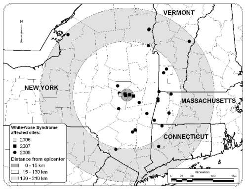
Title: Map Area of White Nose Syndrome
Description: Map showing affected areas where white-nose syndrome has appeared. Location: USA Date Taken: 10/14/2008 Photographer: , U.S. Geological Survey Usage: This image is public domain/of free use. Please refer to the USGS Copyright section for more details. Source: Related to news release: Newly Identified Fungus Implicated in White-Nose Syndrome in Bats: Mysterious Bat Disease Decimates Colonies in the Northeast File Size (original): JPEG Image - 284.74 KB Resolution: 72 dpi Suggest an update to the information/tags? Tags:
|
||||||||||||||||||||||||||||||||||||||||||||||||||||||||||||
Collections
|
|||||||||||||||||||||||||||||||||||||||||||||||||||||||||||||

![]() U.S. Department of the Interior |
U.S. Geological Survey
U.S. Department of the Interior |
U.S. Geological Survey
URL: http://www.usgs.gov/photos/default.asp?p=qvm8PCb54I_11
Page Contact Information: Image Gallery Webmaster
Page Last Modified: Wednesday, July 29, 2009

")


